

 APH
APH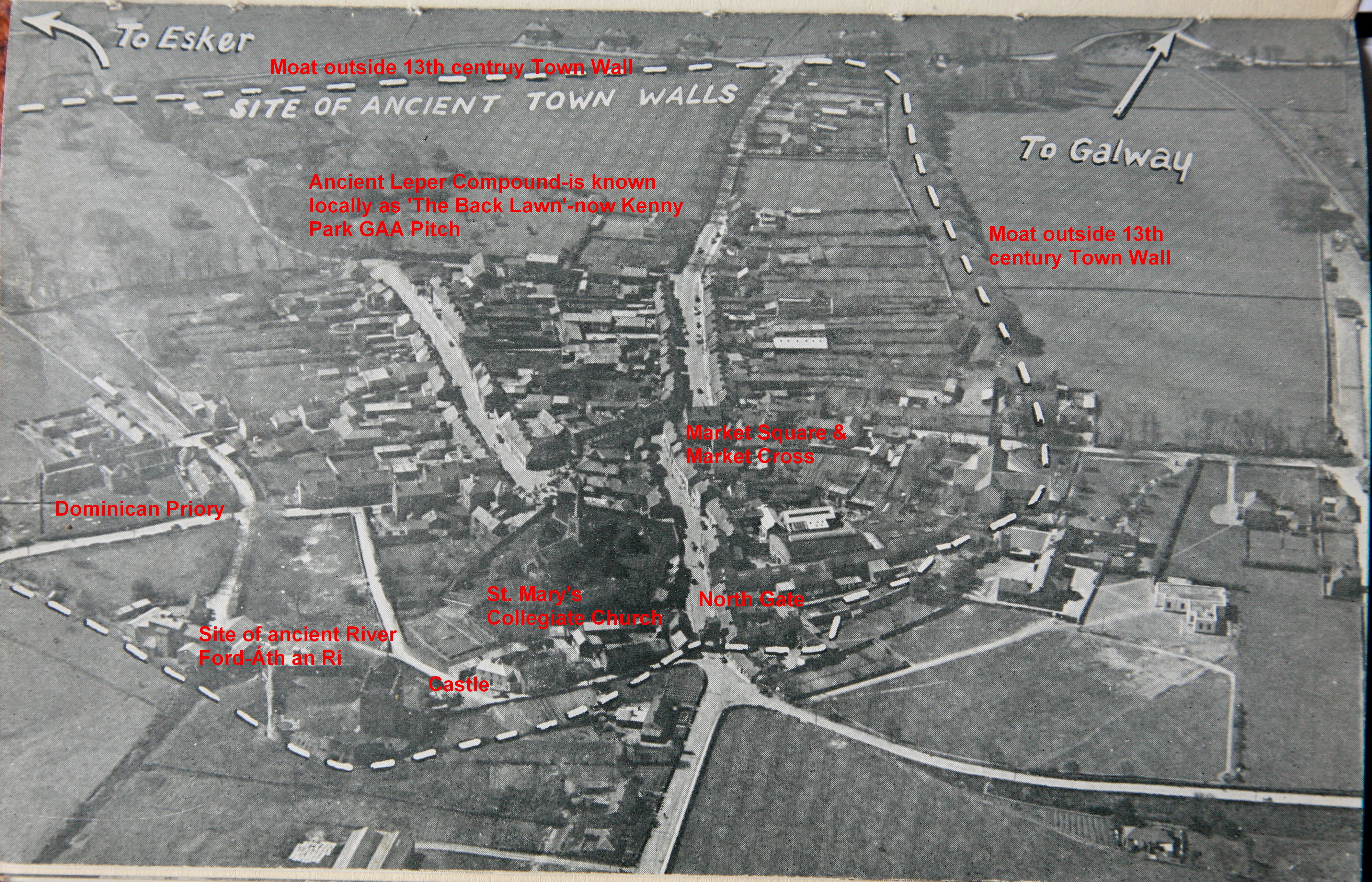
SOURCE: Ordnance Survey letters of County Galway by Michael Herity MRIA
Name
This parish lying between those of Monivea and Killeeneen, derives its name from the town in which the parish church is situated. The name is not of ecclesiastical origin, and, before the year 1211 when, it is said, King John built a city here, Athenry was only a ford on the western boundary of Hy-Many, and the point at which the principalities of (409) Aidne Hy-briuin, and Hy-Many met. This ford was called Áth na Riogh, the ford of the Kings, probably from its being so situated. Camden, however, and other commentators on Ptolemy’s map of Ireland, conjectured that Athenri, was the Auteri of the Geographer; but as Auteri was the name of the people it is not (even) likely that it would be preserved in that of a ford, which Ath na Riogh certainly was, and we need not wonder that the learned O’Flaherty scoffs at such a mode of deriving words, in his Ogygia (Vol. 1 p. 24 Translat.). Besides it will be seen that the Auteri of Ptolemy could not be in Connaught at all, and that we should (rather) look for their name among those of the primitive Irish tribes or territories rather than among those of fords or modern towns. Indeed I have often laid (down) it (to myself) as a true antiquarian rule that if we can ever reconcile Ptolemy’s tribes and Cities with the old Irish topographers, we must apply ourselves to compare (410) (our) Atticoti and other Belgic tribes conquered by Tuathal, who were certainly here in Ptolemy’s time, and our old hill fortresses, which were undoubtedly the Irish cities at the time with his tribes and cities.
History
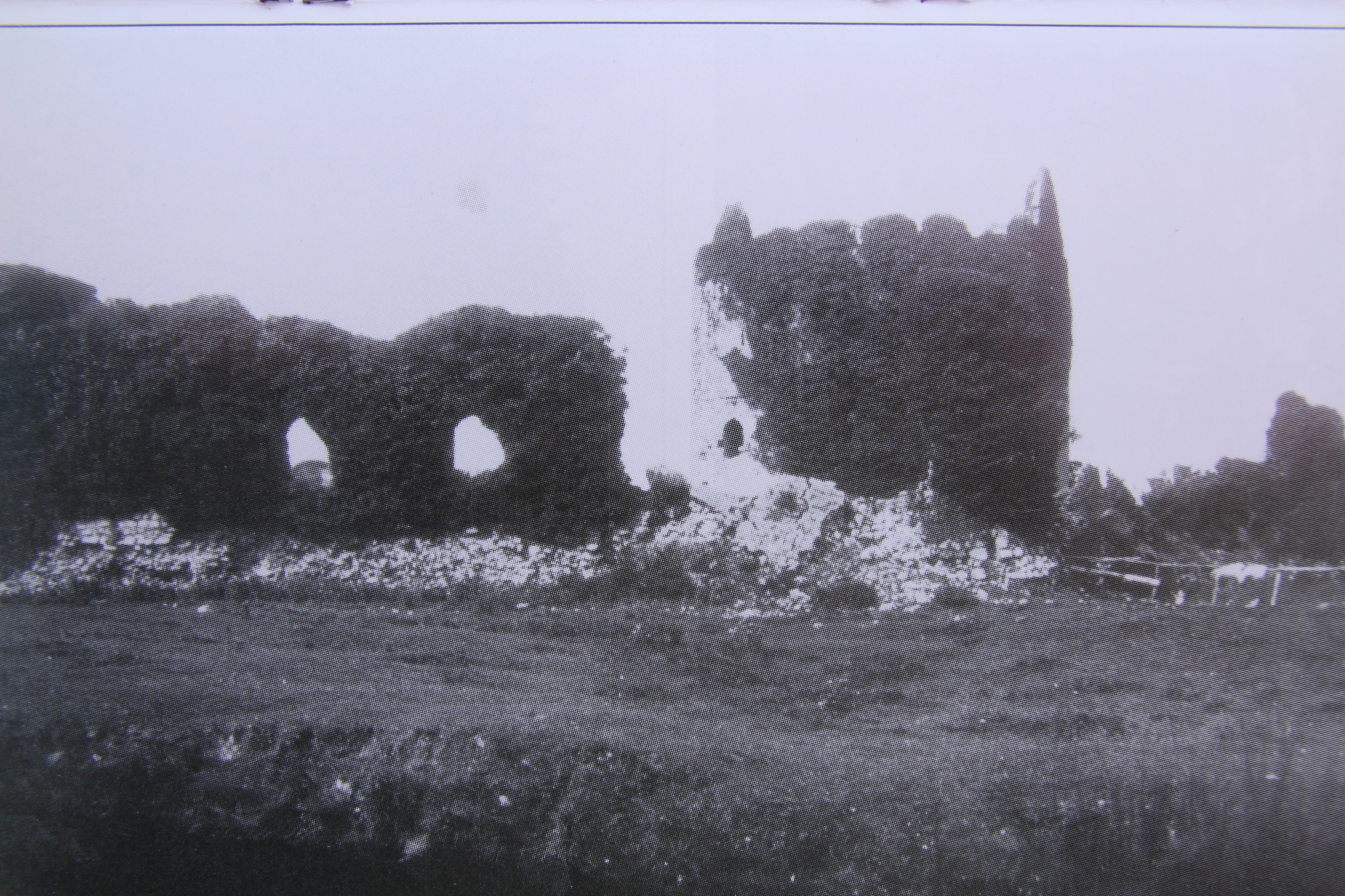
To attempt to give any sketch of the history of Athenry in this letter, would be (a) complete waste of my time, for it would take months to consider the materials before one could begin. It seems to have been built by King John in the year 1211 to put down the Hy-Briuin, Hy-many and Hy-Fiachrach Aidhne, three most ferocious Connachtan tribes. It (In pencil) Athenry was surrounded with a wall of considerable strength enclosing an area of 25 Irish acres (3 acres (it is said) more than Galway) and this wall was originally surrounded with a ditch into which the river was conducted. This ditch is (still) traceable on the east and south sides (where) water still flows through it. The wall was defended with towers and (411) six gates which are called Sparra’s, viz 1. Briton’s Gate. 2. Castle Gate, called in Irish Sparra an Chaisleain. 3. Spiddle Gate, Sparra and Spideil, the gate of the hospital. 4. Lara Gate. 5. Nicholroe Gate, Sparra Niocoil Ruaidh, and 6. Templegate, Sparra and teampuill. All these gates are now destroyed excepting the north (i.e. Britons) gate and a part of Sparra an Chaisleain which are much injured. It does not appear that they (ever) had any ornamental work like the Gates of Derry. One tower remains in tolerable preservation on the South East side.
Abbey
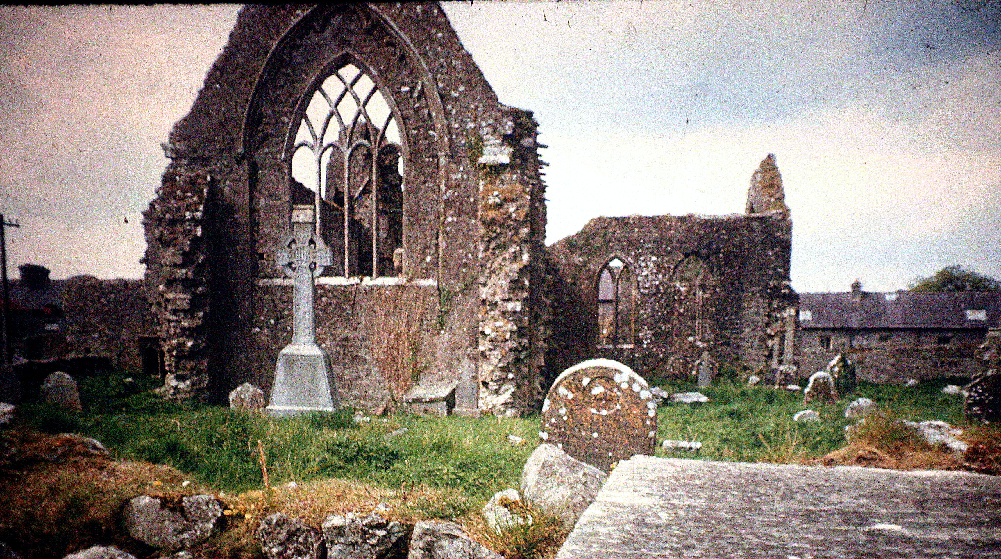
The ‘noble Abbey’ which was erected here in 1241 by Meyler de Birmingham at the request of St. Dominic, is still standing in good preservation, and should be shewn on the map.
The Castle of Athenry called by some King John’s Castle, and by others Birmingham’s Court, is also in good preservation, and a very conspicuous object in the town.
(412) The site of the Franciscan monastery which was founded here in the year 1464 by the Earl of Kildare, is said to be occupied by the church of Athenry.
For the history of Athenry see Cambrensis on the fortresses erected by King John in Ireland; De Burgo’s account of the Dominican Abbeys; Archdall’s Monasticon and the Annals of the Four Masters at the years 1249, 1266, 1316, 1322, 1375, 1473, 1504, 1544, 1572, 1583, 1596, 1599 and 1601.
Castles
In the parish of Athenry are situated, according to the natives, 6 castles, but I saw only some of them, viz. 1. Derrydonnell, 2 Moyweela, 3 Carnaor, 4. Ballydavid, 5. Castle Ellen, 6. Castle Lambert (not ancient). Derrydonnel is mentioned by the Four Masters at the years (1213-14), as having derived its name from the circumstance of O’Donnell having encamped at it for a night when he persecuted the poet Muireadhach O’Daly of Lissadill, and at the year 1598 as the residence (413) of the son of Tibbot MacDavuck Burke, and in an Inquisition taken at Galway in the year 1608 (??) as one of the Castles of Clanrickard.
Moyweela (Moyveela) is mentioned by O’Flaherty (Ogygia part. 3 c.11) as near a brook called Turlach Airt in Aidhne, where the monarch Art, the son of Con of the Hundred battles. was killed after the battle of Moy-Mucroimhe.
Of the Situation of Moy-Mucromha
This plain is celebrated in all the Irish histories and authentic annals as the site of a bloody battle between Looee Mac Con and Art, the solitary, Kings of Ireland, in which Art was defeated, and after (wards) pursued to a brook in Aidhne situated between Moyweela and Kilcornan, where he was killed.
The account of this battle forms one of the popular stories of the (ancient) Irish. I have an (414|) extract from a very rude copy (of it) now before me but I find nothing in it to (point out) the situation of Magh Mucroimhe. O’Flaherty, who lived at a period when old Irish traditions were very vivid, and (who had) many excellent Irish MSS. in his possession, writes in part 111. c. 11. of Ogygia, that Moy Mucroimhe was situated near Athenry, 8 miles from Galway, and in his account of Iar-Connaught he states that Looee Mac Con defeated the monarch Art at Athenry within 8 miles of Galway.
Where did O’Flaherty find, or from what did he infer that Athenry was in Moy-Mucroimhe, or Moy-Mucroimhe near Athenry? Try the Annals and all the copies of the account of the battle. Where did he find that King Art was slain at the little river of Turlach Airt in Aidhne? I made every enquiry in the parish of Athenry to see if the name Moy-Mucroimhe were still (in existence) but found that no such is remembered; and (415) what I am more surprised at, the name Turlach Airt, (situated between Moyweela and Kilcornan) which was generally known in O’Flaherty’s time, is now blotted from the memory of the people. Does any such name occur in the Connaught Inquisitions?
That Magh Mucrimha was a well-known plain in ancient times appears from a legend concerning it in the Dinnseanchus in which its name is derived from a magical herd of swine which was dis-enchanted there by Queen Meave. From the manner in which this plain is mentioned in the Dinnseanchus, it would appear to have been rather the name of a fertile district than of a small field or townland.
Magh Mucrima molor cach
Magh a ragam co ro gnath &, &.
(416) The plain of Mucrima which all have praised,
A plain which I have oft with joy traversed
A plain of houses, ploughmen and of herds
Which Eochy Fin’s great tribe have long possessed,
A land so smooth (reigh), so rugged (aimhreidh!) and so tilled (ro-ar)
Extensive (fairsing), wide (ro-leathan) and splendid (ro-ghlan), grasy-green.



