APH
APH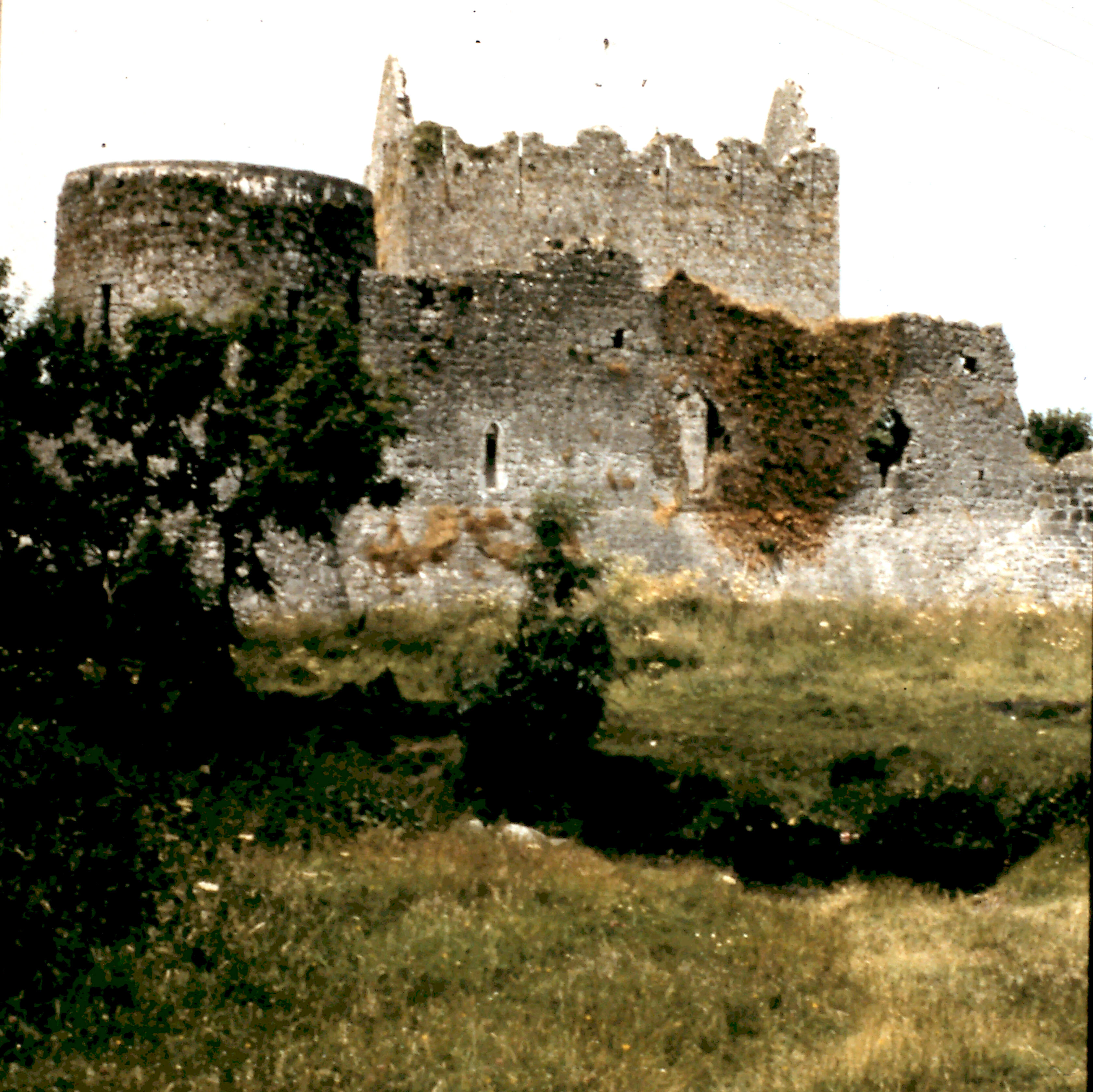
A Set of Slides with Notes and Questions produced and sponsored by Athenry Project Society in 1982.
Copies were gifted to Parish National Schools.
Camera and Graphics by Francis Kennedy
Text by Gerry Ahern
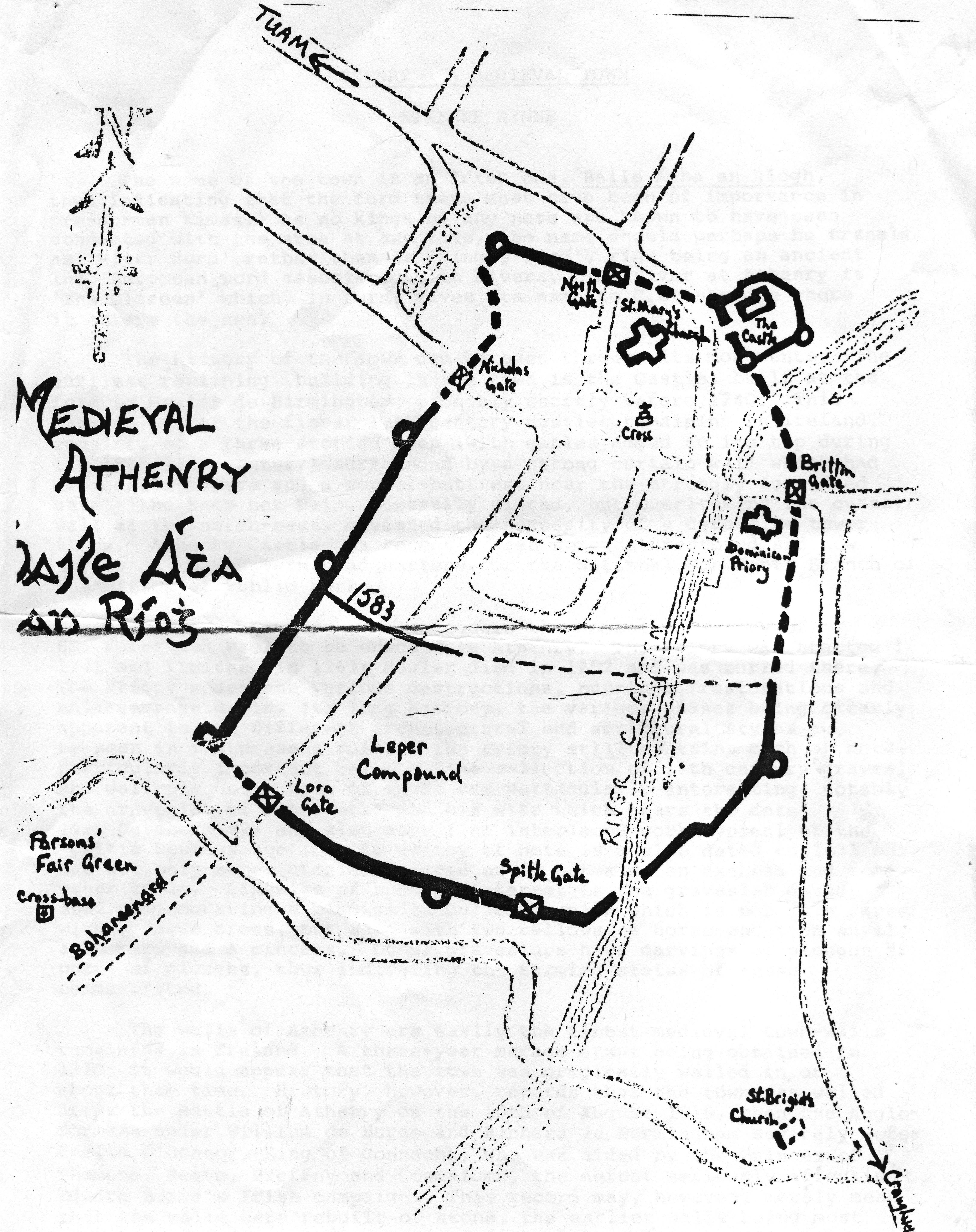
The name “Baile Atha an Riogh” has been translated as “River Ford” rather than “Kings Ford” – rige being the ancient Indo European word associated with rivers. As no written history of pre-Norman times exists, we can only surmise that the ford was of importance due to the fact that the three ancient kingdoms of Hy-Many (O’Kelly), Hy-Briuin Seolo (O’Flaherty) and Hy-Fiachrach (O’Hynes) touched at the Ford. It was an ideal place to build a stronghold, which could be used to control the ‘traffic’ passing at the Ford. This was not lost on the Normans who saw it as an opportunity to increase their wealth (by taxing the traffic) and strengthen their power over the Irish. Through this series of slides we will examine the famed monuments of Athenry and from them get a picture of what life was like in those medieval days 774 years ago.
The Castle.
 SLIDE 1. Castle & River.
Following the conquest of most of Connacht by William de Burgo, Peter de Bermingham, first Baron of Athenry, was granted the lands around Athenry. The first Norman settlement was probably of the Moat & Bailey type. Later on, c.1240 his son Meyler had what is known today as ‘King John’s Castle’ built. (King John never visited Athenry as he was long dead by 1235. Notorious as a cruel ruler his name may have been given to the place to scare the Irish and as well to give it prestige) We see the river Clarin and the sloping land in the foreground. Was this the Ford of ancient times?
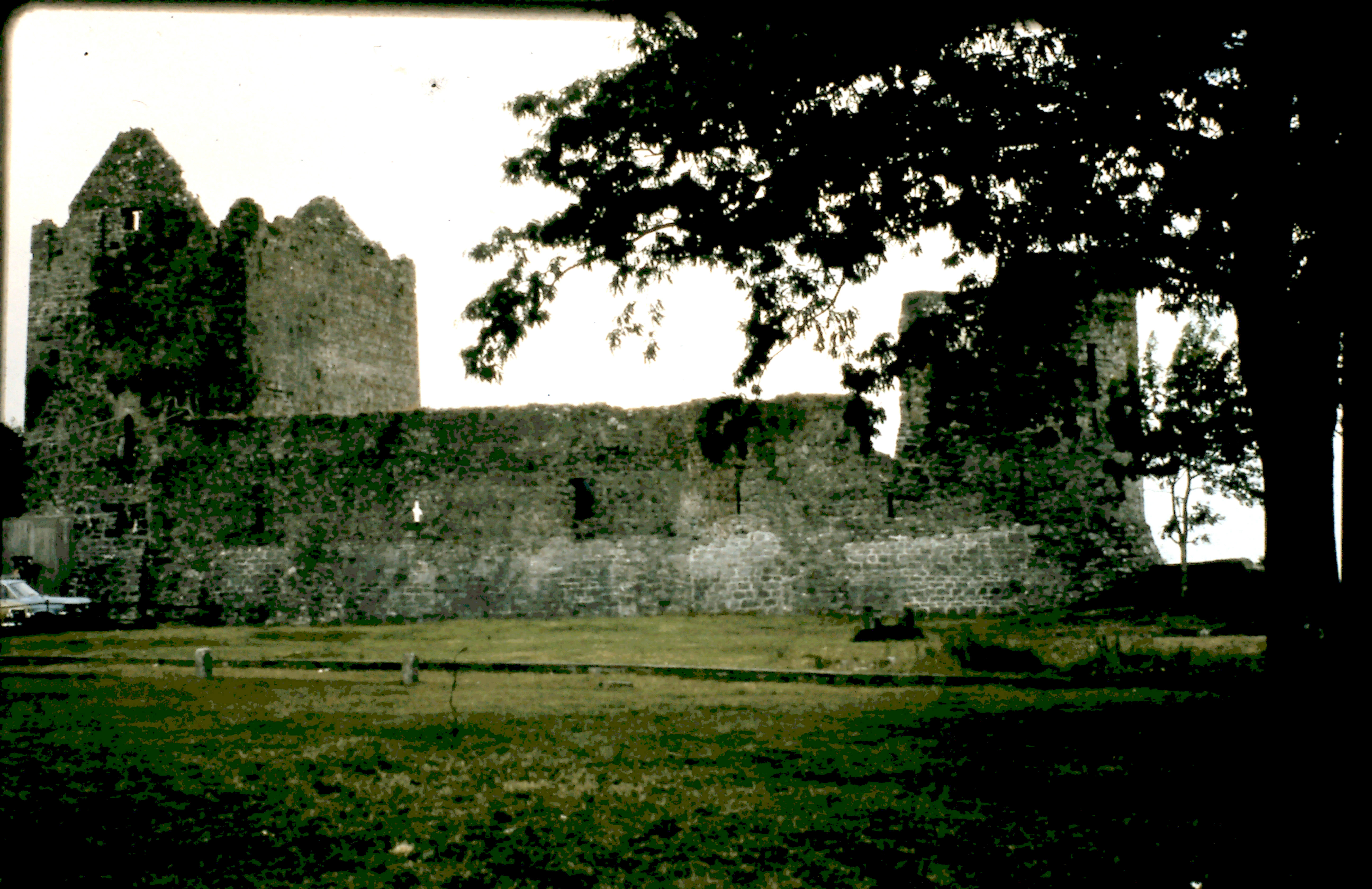
SLIDE 2. Castle & Curtain Wall
The castle is one of the finest 13th century castles in Ireland. It consists of a three storied keep (with gables added to its top during the 15th and 16th centuries) surrounded by a strong curtain wall which had two corner towers (right of picture) and a corner-buttress near the strongly fortified gate. The keep, not being centrally placed, but overlooking the curtain-wall at the north-east, obviated the necessity of a defensive wall tower there. It was surrounded by a wet ditch fed from the river which washed its eastern side. (The river bed was lowered 6’ at the time of drainage works, after the Famine of 1847).
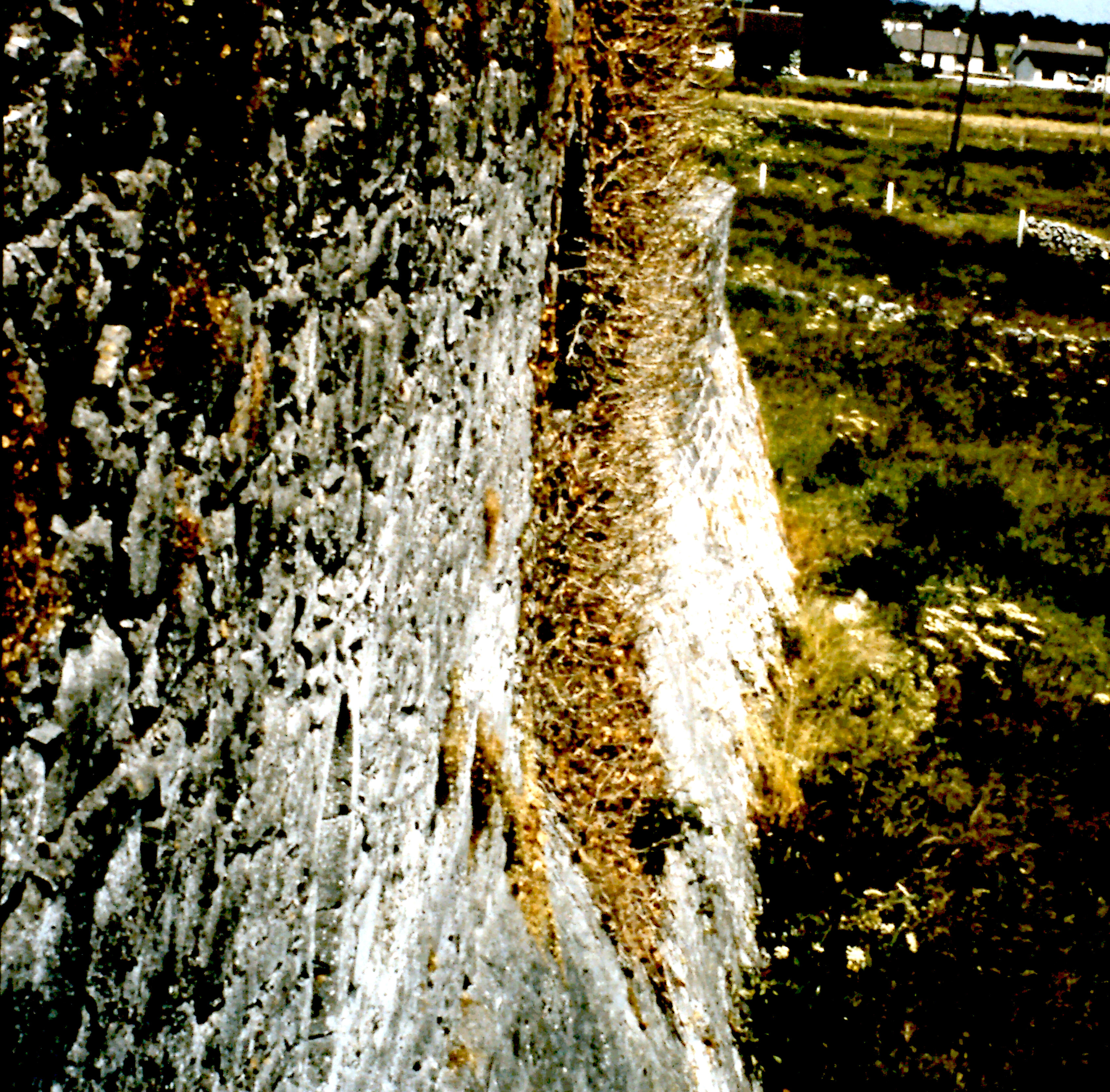
SLIDE 3. Buttressed Curtain-Wall.
From the only remaining corner-tower we look out through one of its windows, and view the buttressed curtain-wall. These buttresses prevented the enemy from laying close to the wall out of sight of the defending Normans.
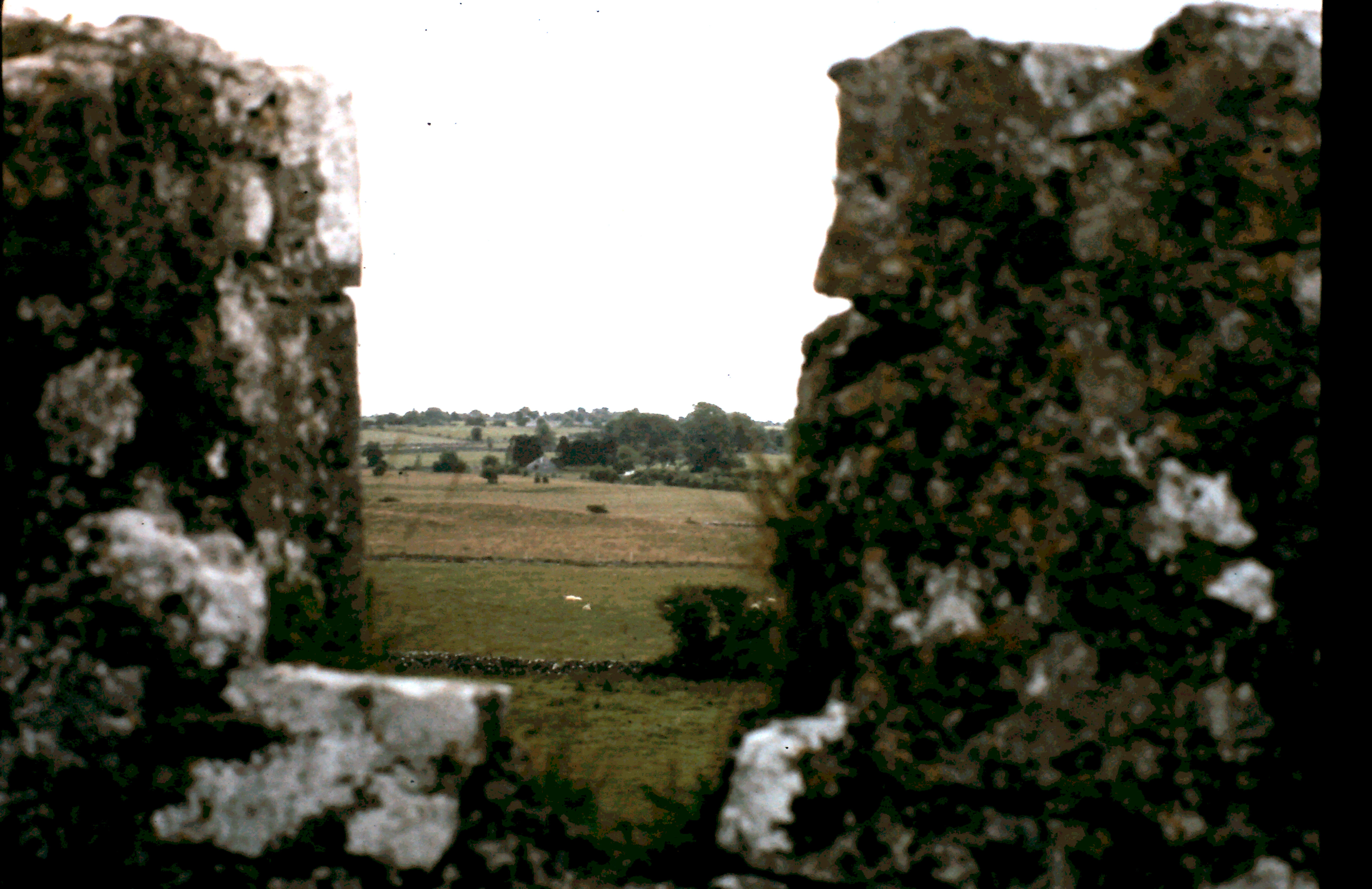
SLIDE 4. The Battlements
Up on these battlements, which were higher than they are now, the Norman soldiers shot their arrows through narrow slits. These offered protection to the archers and the sloping angle assisted the aim of the bowmen.
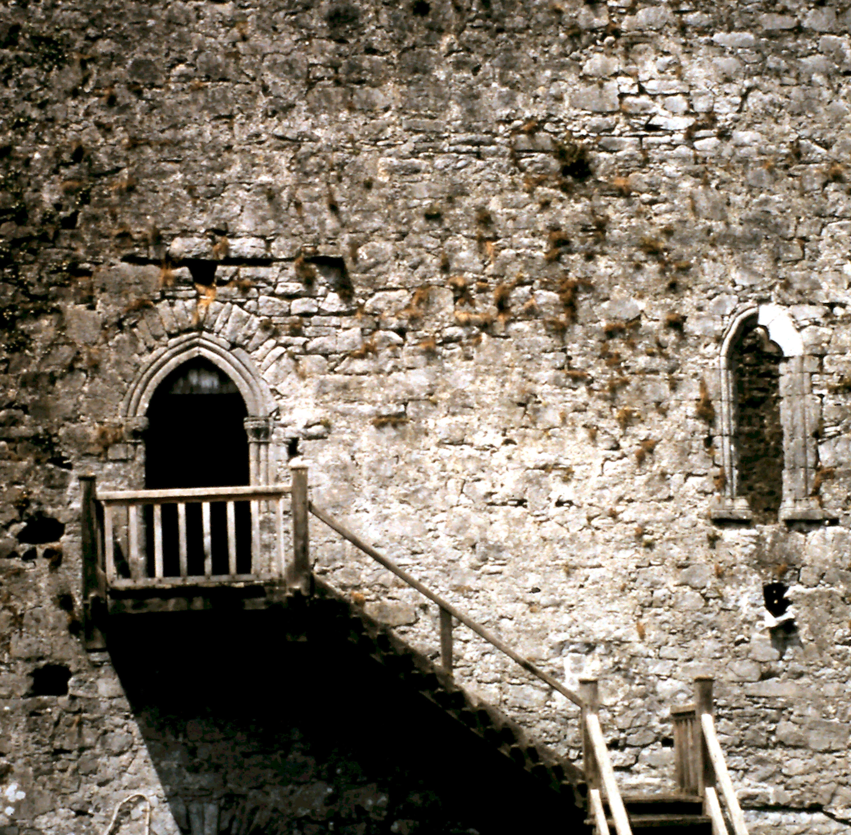
SLIDE 5. External Stairs.
As in most of the 13th century castles of England and Ireland, access to the interior was by a door on the first level by means of an external stairs. This is a reproduction stairs made by the Bord of Works whose headquarters are located in the castle. This narrow stairway could easily be defended and if destroyed allowed protection to those on the first floor by its height from the ground. The lower doorway led into the basement of the keep where goods and animals were kept.
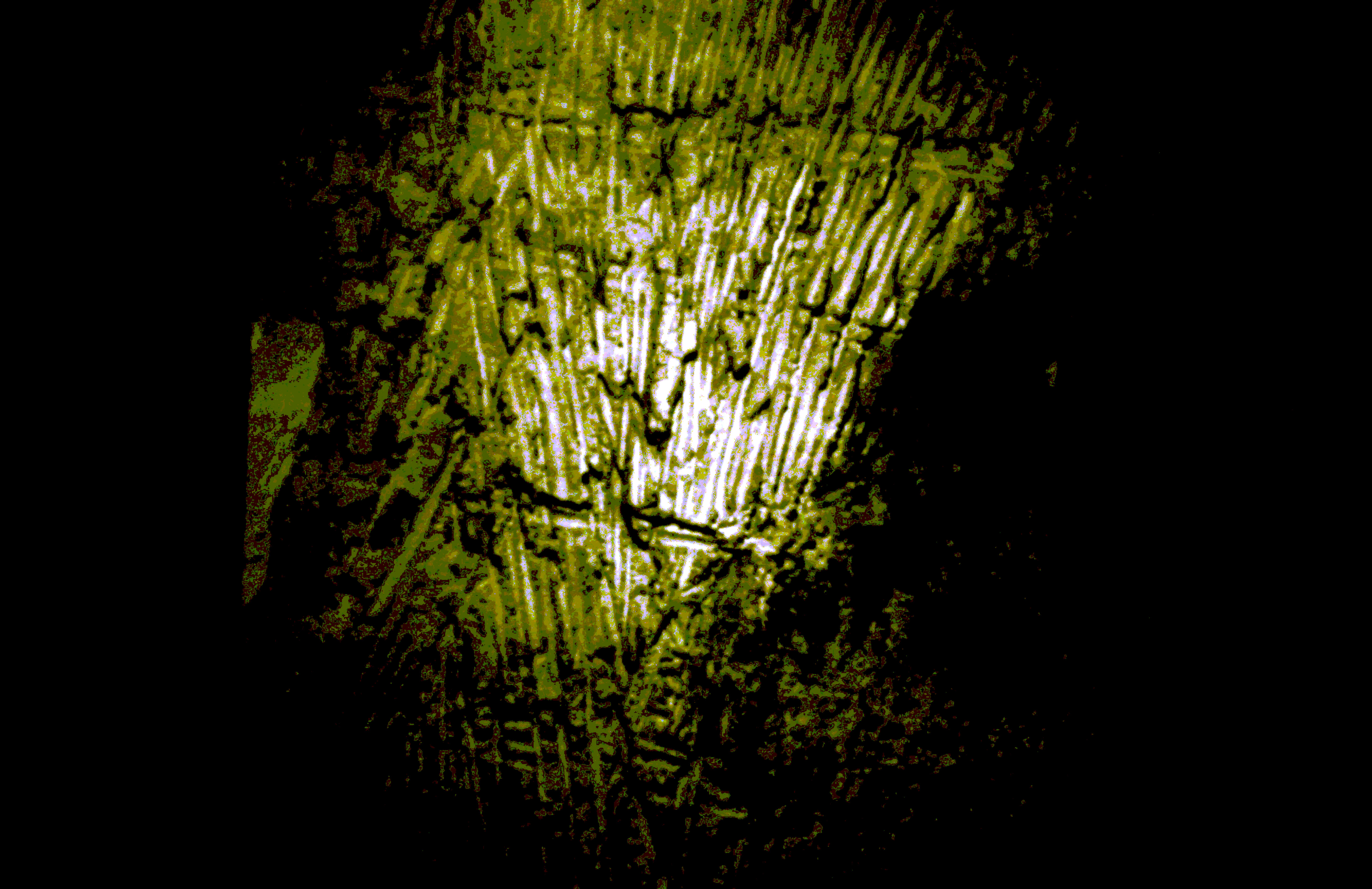
SLIDE 6. Roof of Basement.
The basement roof still bears the plaster from Norman times. Imprints of the wattles which held against the roof are clearly visible.
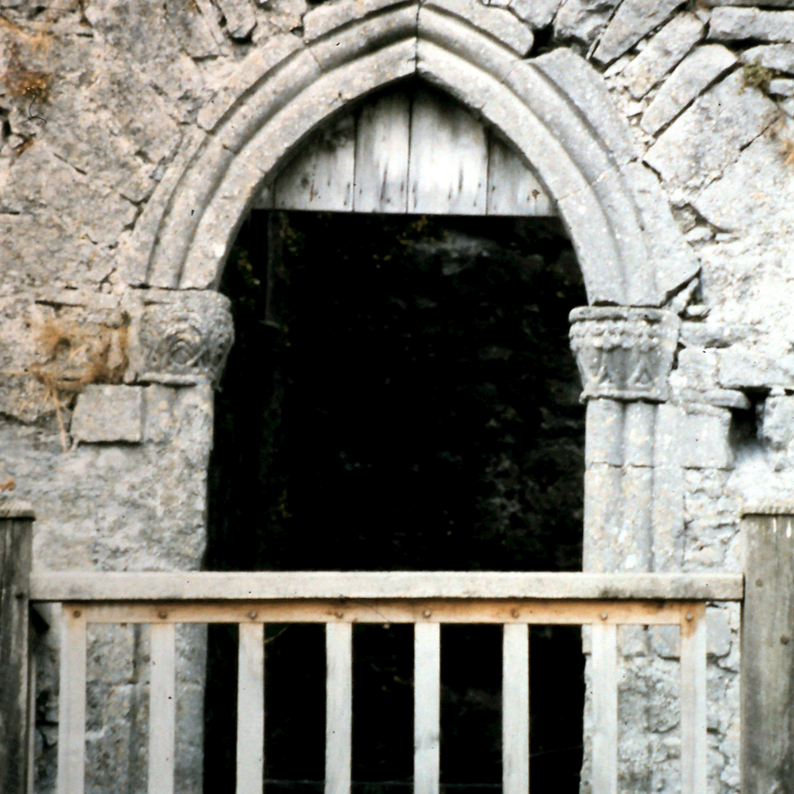
SLIDE 7. First Floor Doorway.
Here we see the effort (probably of Lady de Bermingham) to break the drab uniformity of the castle stone, by erecting this beautiful early Gothic Door.
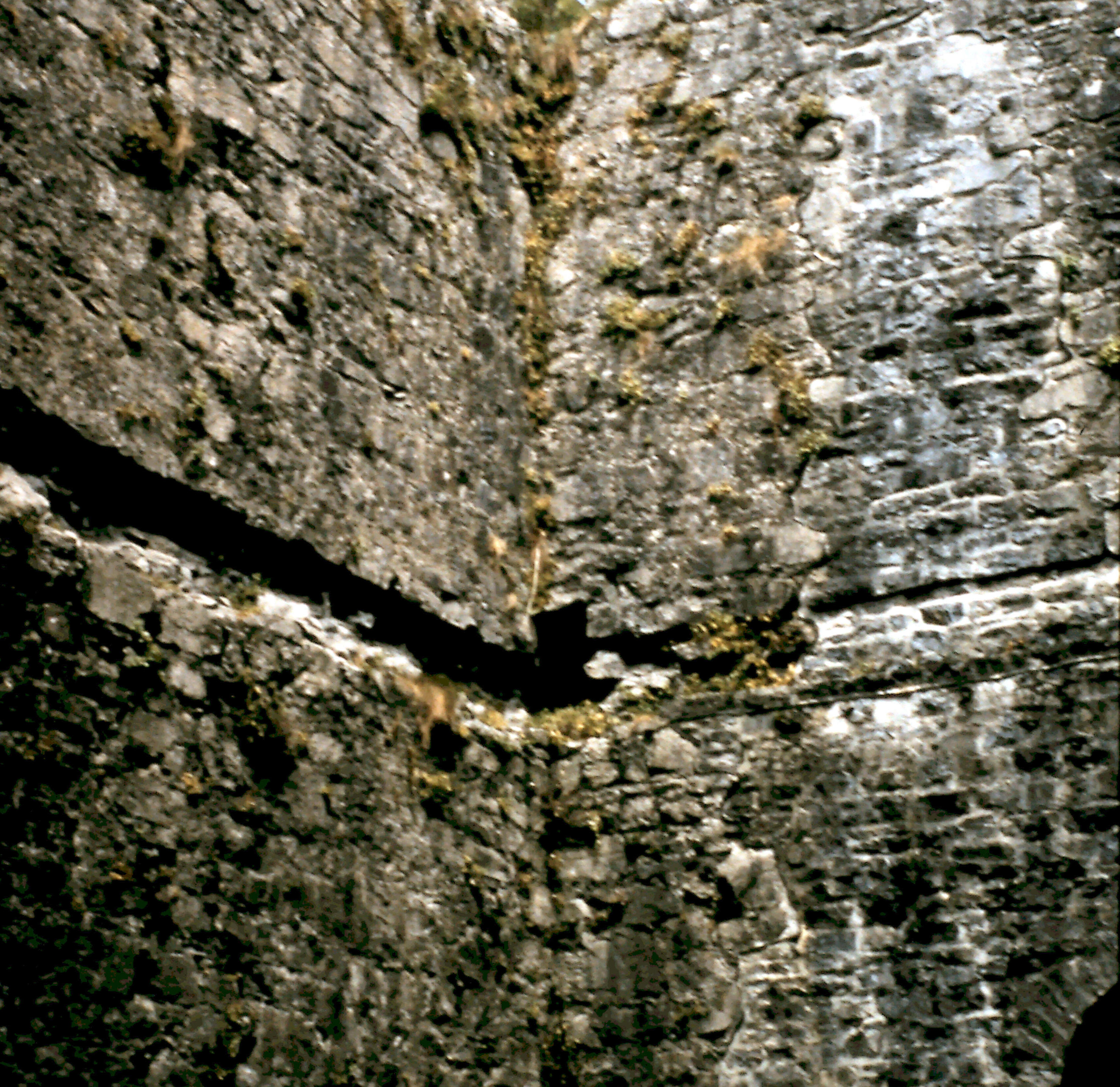
SLIDE 8. Interior of Castle.
The great hall was lighted by four windows in the centre of each wall face that which was in the north wall has been removed and that in the west wall is a simple foliated lancet. This hall had no fireplace and must have been extremely cold during winter. All cooking was done outdoors. The windows were wide in the interior and narrowed to the exterior. During cold weather, a heavy curtain kept out the chill wind. The upper room above the main hall (top of picture) which was a later addition,was lighted by square openings in the gables. The battlements are of a simple plan and each corner rose to form a turret.
CONSOLIDATION
1. Questions on above. Sketch the castle (homework).
2.Make a model of the castle. (Art& Crafts)
3.Write an imaginary account of a visit to AthenryCastle during Norman occupation.
TOWN WALL AND GATES.
These are the most extensive and finest mediaeval town walls in these islands and can only be compared to York.
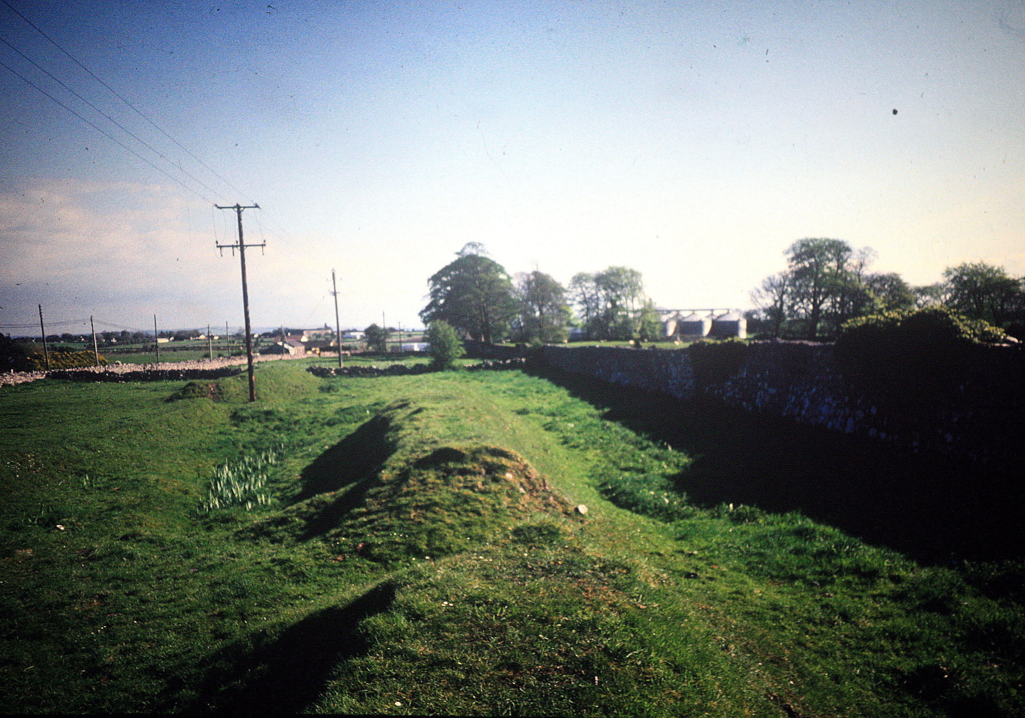
SLIDE 9. EARTHEN RAMPARTS.
The date of the building of the walls is divided into two periods, that of the earliest fortifications in the 13th century with earthen ramparts, and that of the walled town in the middle of the 14th century. These earthworks protected the town sufficiently even at the time of the battle of Athenry 1316 (see map). On the 10th of August of that year, the Anglo-Normans under William de Burgo and Richard de Bermingham severely defeated Phelim O’Connor, King of Connacht, who was aided by the Princes of Thomond, Meath, Breffny and Conmaicne. This defeat seriously affected Edward Bruces Irish campaign, as 60 Irish Princes and Lords were among 8,000 slain. It is said that the victors walled the town out of the profits of the arms and armour taken from the fallen.
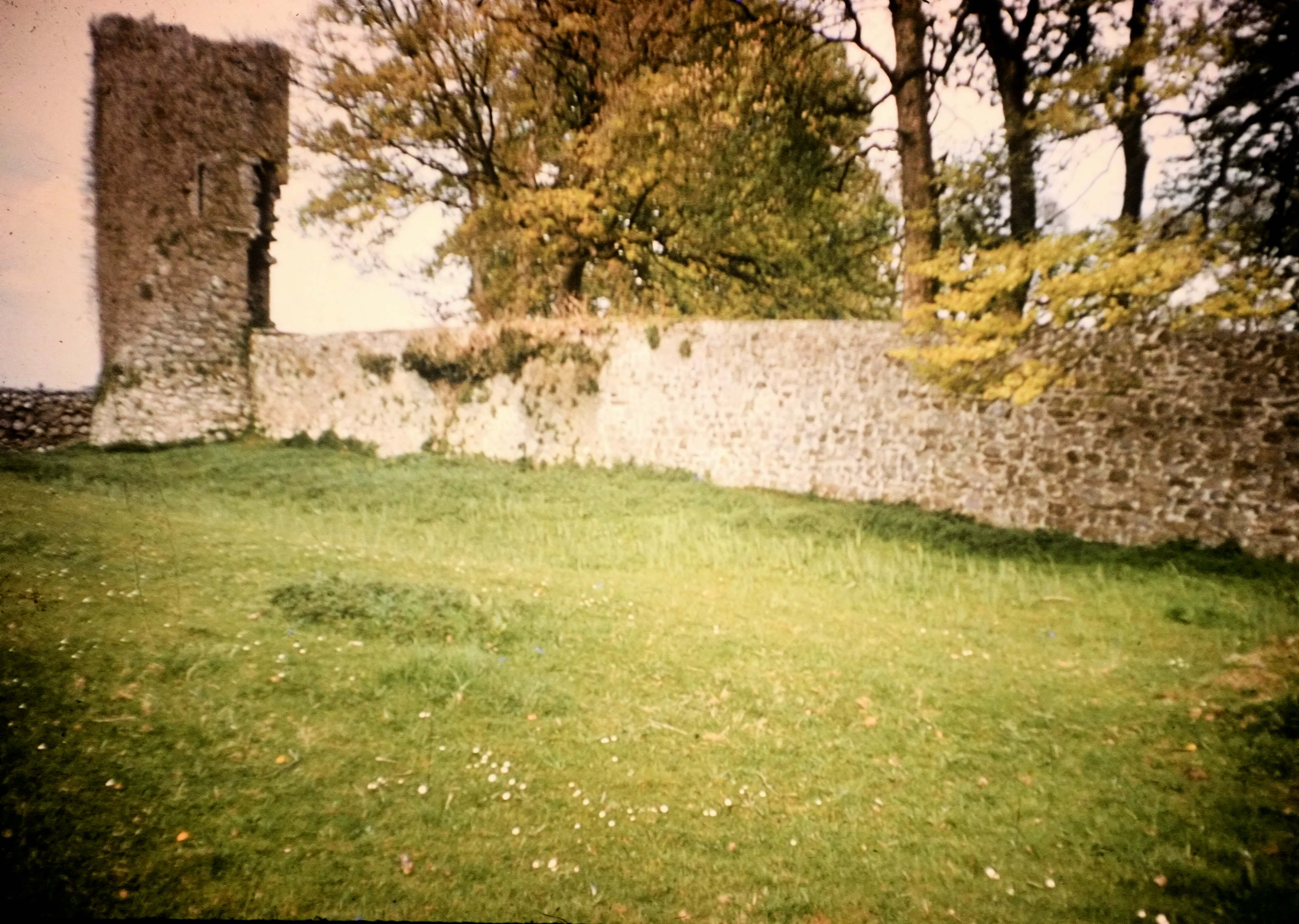
SLIDE 10. EASTWALL AND TOWER.
In 1310 a three year murage grant was obtained but work did not commence until after 1316. The present height of the walls are 12-15 feet on the inside and 20-23 feet on the outside.
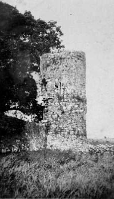
SLIDE 11. WALL-TOWER ON EAST SIDE.
Five of the wall-towers remain and up to recently the footings of a sixth. This was bulldozed away without thought or consideration. These may have had conical roofs originally. The convent and east tower (picture) rise higher than the walls by 10 feet.
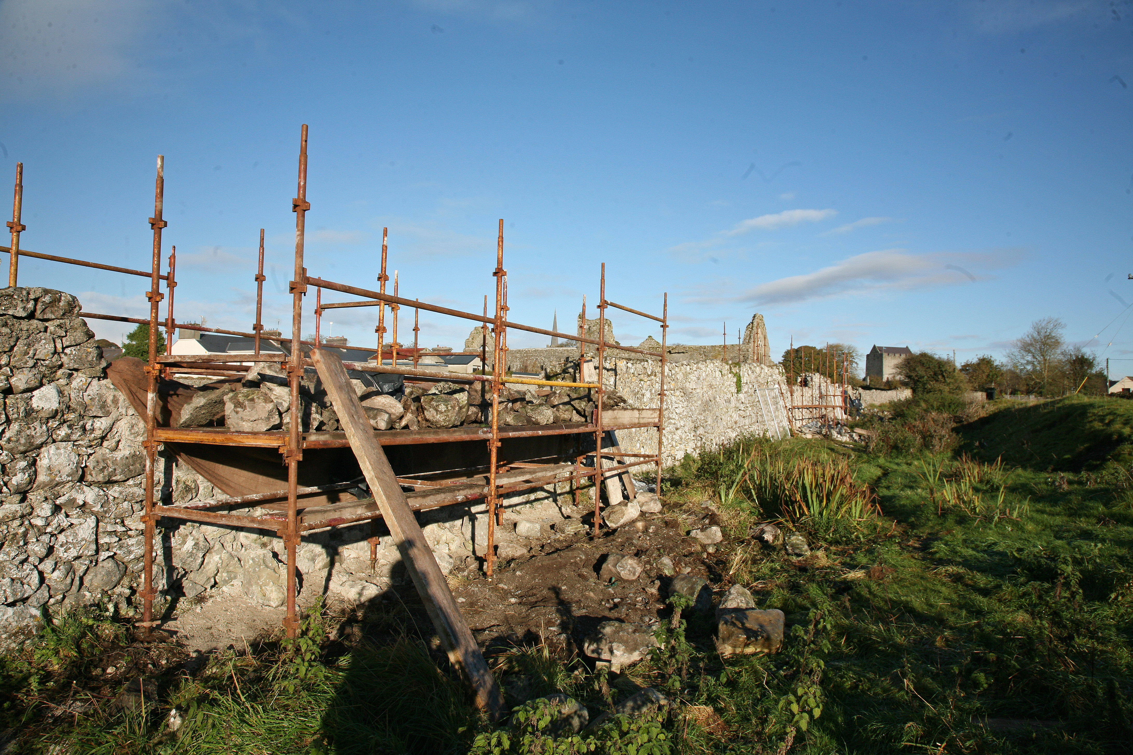
SLIDE 12. WALL AND MOAT.
The walls are but 2-3 foot thick and too narrow to be effective defences. They don’t even have ramparts to allow defenders to man them. The walls and their towers were built to provide some added protection and to lend status to the town. The main defence was the moat (lower right of picture) traces of which can be clearly seen outside the western wall. It is probably that the river ran outside the east and west wall.
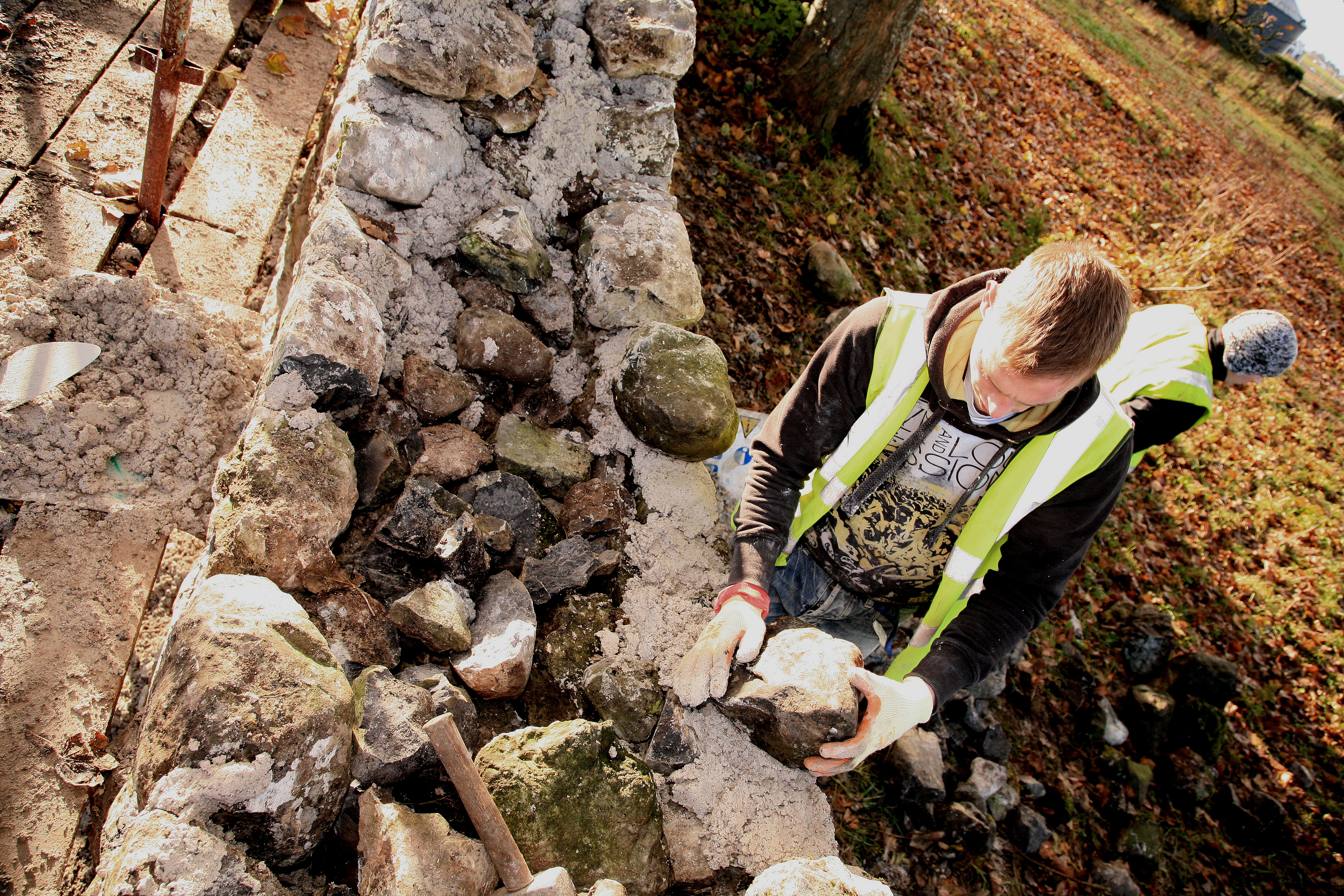
SLIDE 13. INTERIOR OF WALLS.
The walls’ interior was of loose rubble as seen in the photo. The walls enclosed an area of 25 acres. Most of the principal buildings are situated on the northern end as the leper compound was at the opposite end. (see slide 20).

SLIDE 14. NORTHGATE.
Of the five town gates, the only one remaining is the Northgate – known locally as the “Arch”. Legend has it that when the most handsome man in Ireland walks under it, the “Arch” will collapse. The other gates were: Nicholas Gate situated near the present Catholic Church. Lorro Gate called after lord, on the road to Galway. Spittle Gate is connected with a hospital. Inside Spittle Gate was a Leper compound where people with various diseases were kept. Britten Gate is called after Breathnach meaning Walsh, the man who sold the land to the Monks to build their priory.
CONSOLIDATION
1. Questions on above.
2. Further research on Moat &building.
3. Draw and sketch any of the above monuments.
DOMINICAN PRIORY & ST.MARY’S COLLEGIATE CHURCH.

SLIDE 15. DOMINICAN PRIORY (Refer back to slide 14 Britten Gate.)
Meyler de Bermingham bought the site for 160 marks from Breathnach and gave it as a gift to the Dominicans. He also granted them 160 marks for materials and labour. Construction commenced in 1241 and was completed in 1261 and was named the priory of St. Peter & Paul. Meyler died in1252 and was buried there. His church was the burial place in the middle ages,of Earls of Ulster and of the chief Irish families of the west, but the monuments were destroyed by Cromwell’s soldiers.
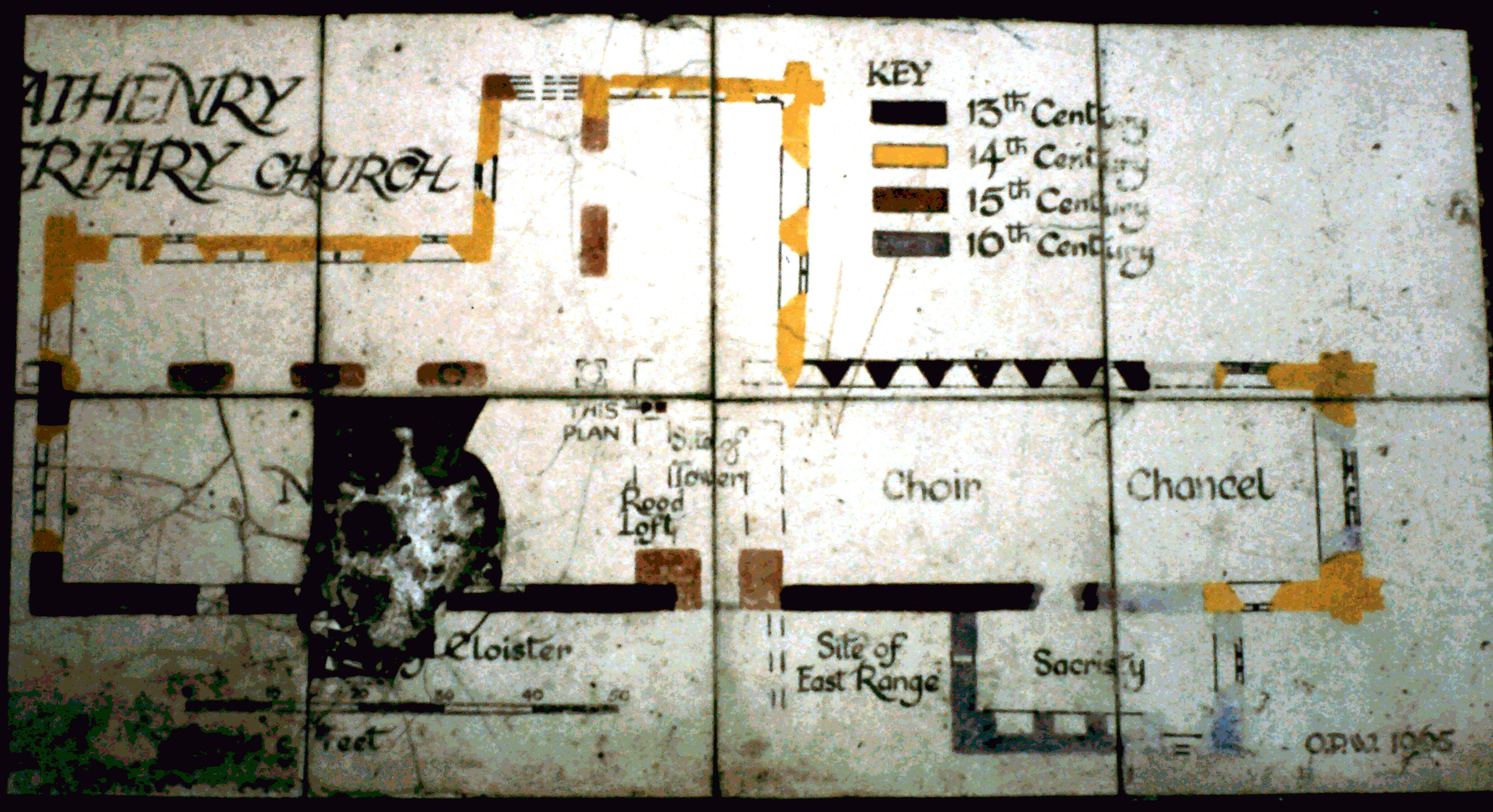
SLIDE 16. PLAN OF PRIORY.
Though an Anglo -Norman foundation, it owed much native Irish patronage: the refectory was built by Phelim O’Connor (d 1265) son of Cathal Crovdery; the dormitory by Eoghan O’Heyne; the chapter house by Conor O’Kelbey. In the 14th century, the choir was extended and the north aisle and transept added. A century or so later, a bell tower (now vanished) was inserted between nave and chancel. A disastrous fire in 1423 entailed large scale rebuilding and much of the work was of inferior quality, especially to aisle and transept arches.
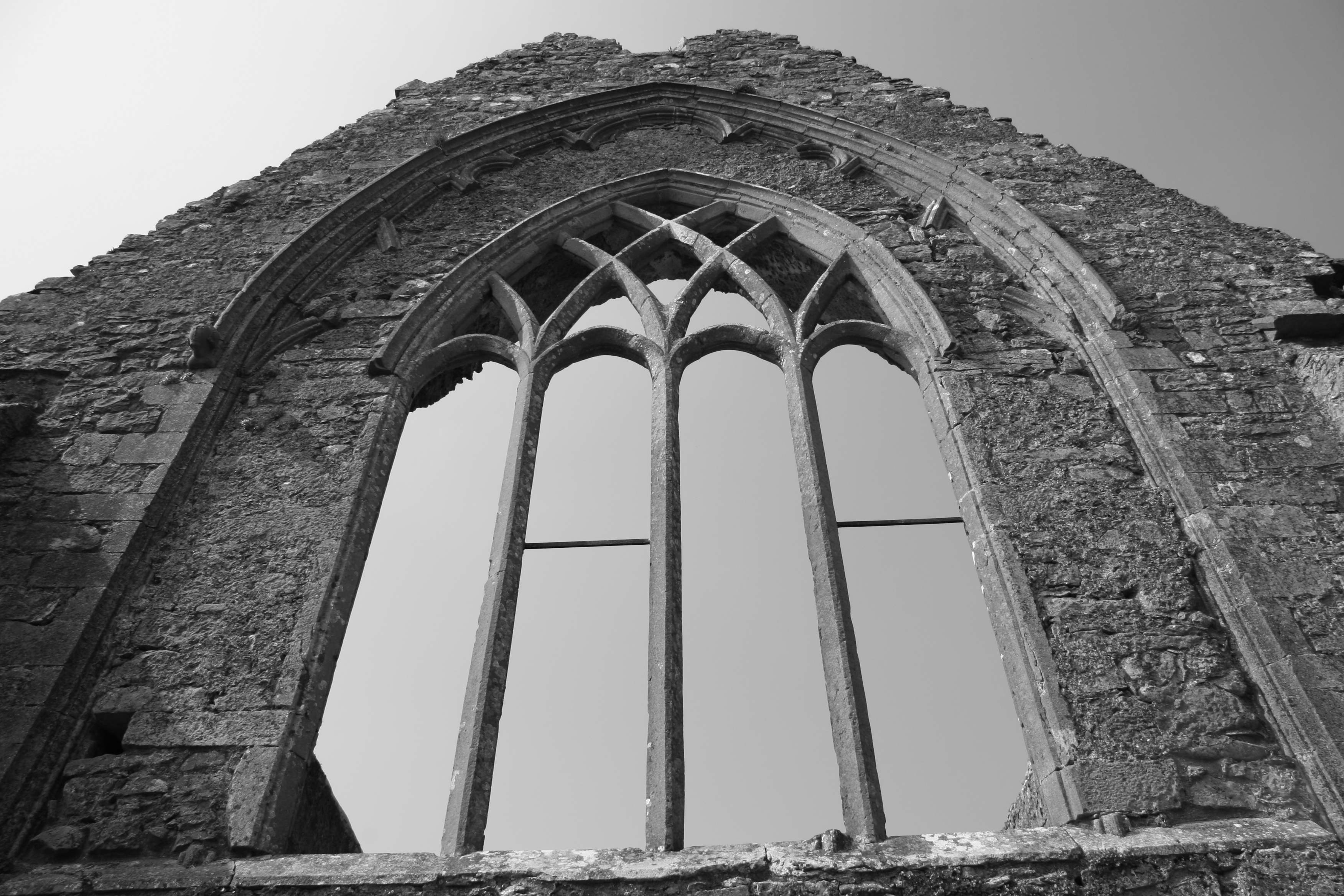
SLIDE 17. IN THE 16TH CENTURY THE PRESENT EAST WINDOW WAS INSERTED INSIDE THE REMAINS OF ITS NOBLER PREDECESSOR.
Being in the land of the Irish, the friary was specifically exempted from Henry VIII’s dissolution of the monasteries. In 1574, however, it was dissolved and granted to the town. That very year, town and friary were sacked by Clanrickards sons. In February 1597, Red Hugh O’Donnell sacked the town, following which Athenry descended into a continuous decline, briefly halted in 1644 when the Dominican Priory was revived as a university, only to be finally put down by the Cromwellians in 1652. Early in the 17thcentury, the friars returned and remained in possession until the Cromwellian victory in 1652. About 1750 the conventual buildings (dormitory y etc.) were demolished to make way for a military barracks, whose occupants wrecked the funerary and other monuments.
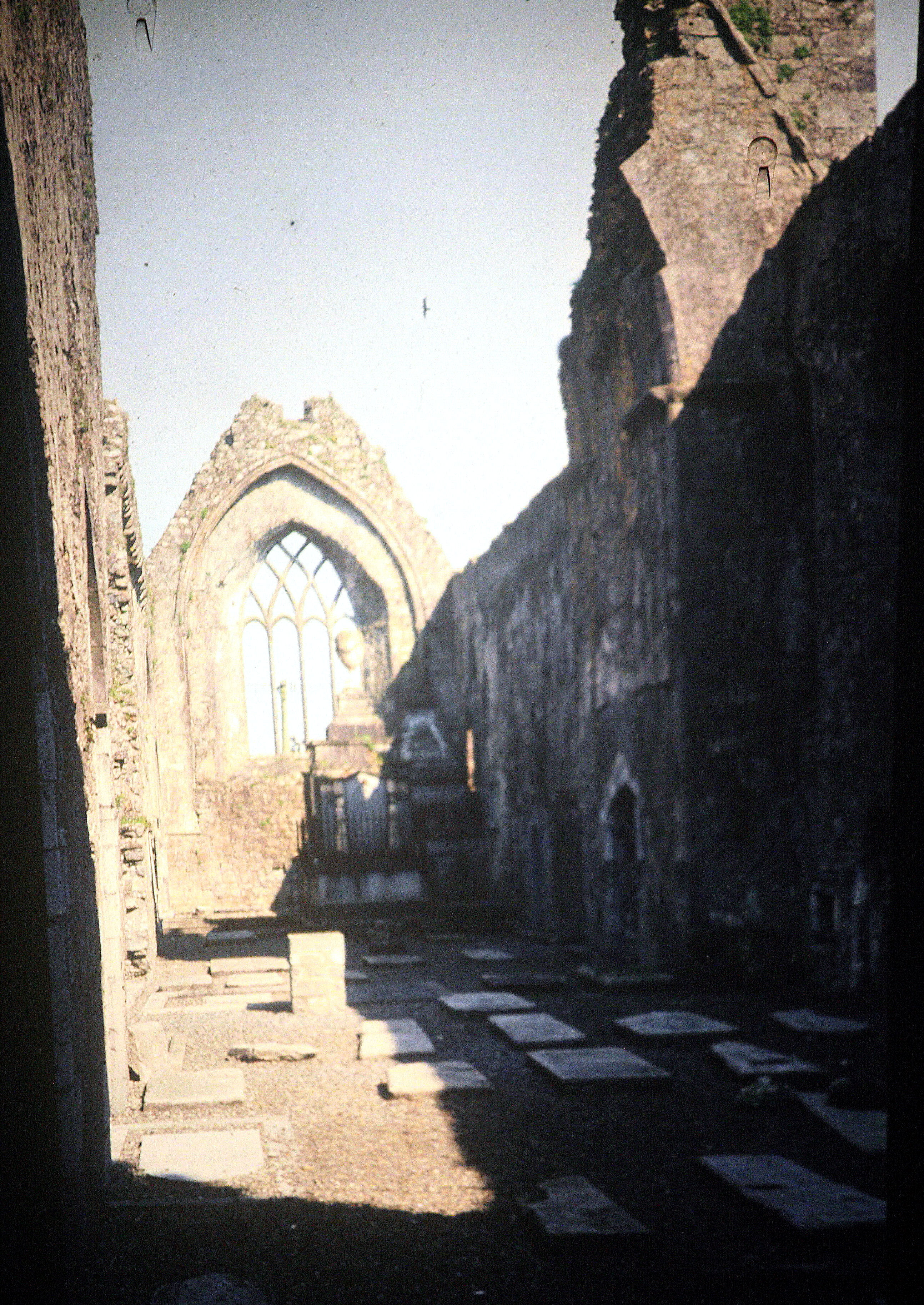
SLIDE 18. INTERIOR OF PRIORY.
The Priory still contains much of note, particularly important being a fine collection of grave slabs and plaques. Some of these are particularly interesting, notably the grave slabs of John Burke and his wife which bears the date 12th October 1627 and some fine interlaced work typical of the Celtic Renaissance. Also worthy of note is a slab dated 1631 which has not only some interlaced carved on it, but also an axe head and some tools. As well, of special interest is the grave slab dated 1682 commemorating a blacksmith called Tannian, which is not only carved with a large cross but also with two bellows, a horseshoe, an anvil, a hammer and a pincers. Other slabs have carvings of ploughs or parts of ploughs, thus indicating the farming status of those commemorated.

SLIDE 19. ST. MARY’S COLLEGIATE CHURCH
The remains of St.Mary’s Collegiate Church, the former parish church of Athenry, dates from the mid 13th century. Founded c. 1240, it became collegiate by order of Archbishop O’Murray of Tuam in 1484. It was destroyed in1574 by Clanrickard’s sons. In 1828 a church with an elegant spire was built in its chancel and was in use by the Church of Ireland until some years ago.
CONSOLIDATION
1. Questions on above.
2. Make a model of the Priory.
3. Research – Dormitory, Refectory, Chapter House.
COMPOUNDS, MARKETS AND FAIRS.
SLIDE 20. LEPER COMPOUND.
The land now occupied by ‘Kenny Park’ hurling pitch (background) and the Taylor Family (foreground) was known as the Leper Compound. It is debatable whether or not there was leprosy in Ireland, but we can definitely assume that this area of the town was reserved for those who suffered from what are now common diseases – chicken-pox, measles etc. This fact is further enhanced by the presence of a hospital near Spittle gate.
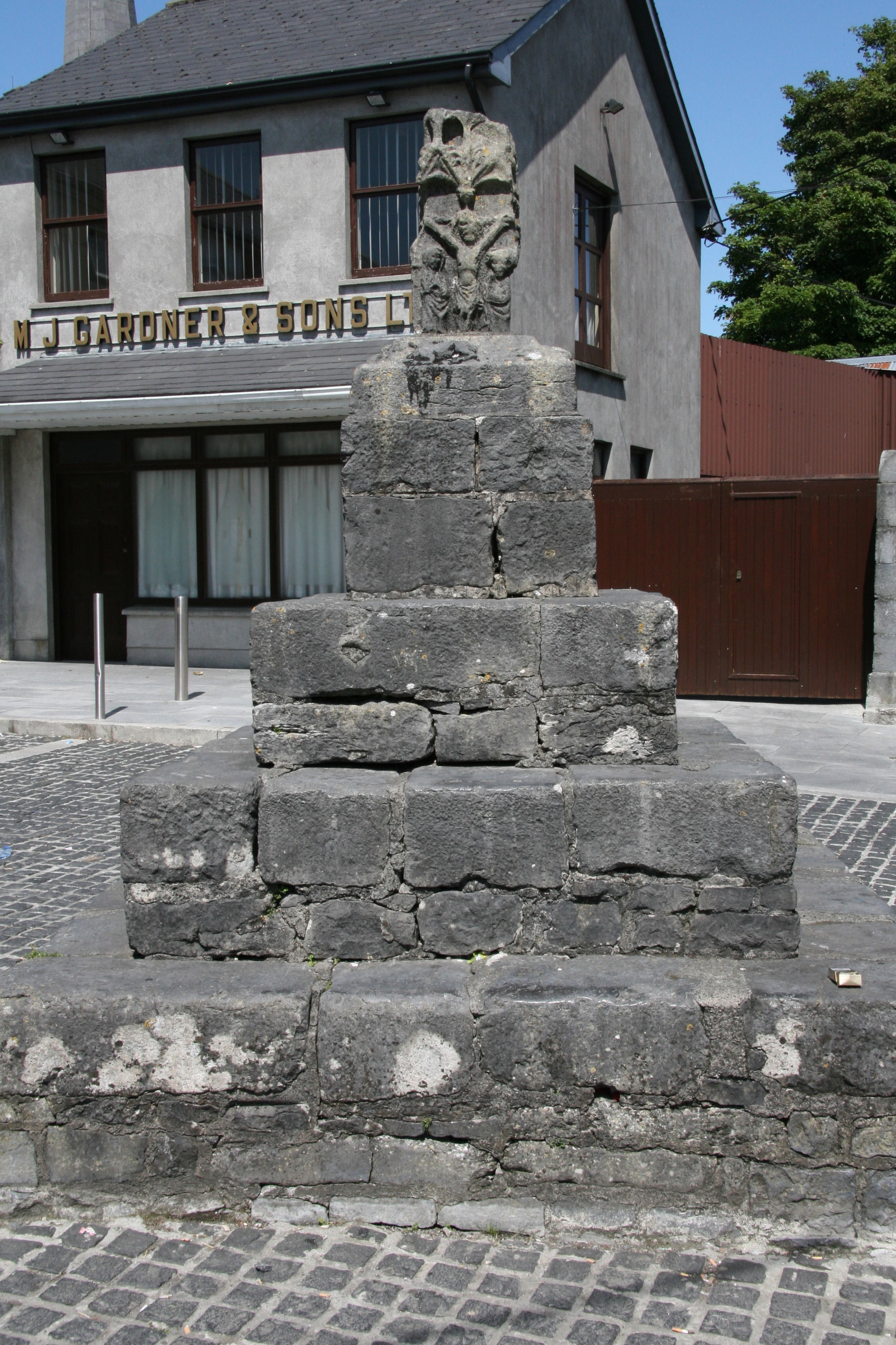
SLIDE 21. MARKET CROSS (Map)
In 1629 permission to hold a regular market andfair in October was granted to Sir William Parson, Bart. The market was held each Sunday within the town, at the spot where the remains of a very fine cross still stands. This cross is unique in Ireland, being of ‘Lantern’ or ‘Tabernacle’ type and it dates from the 15th century.
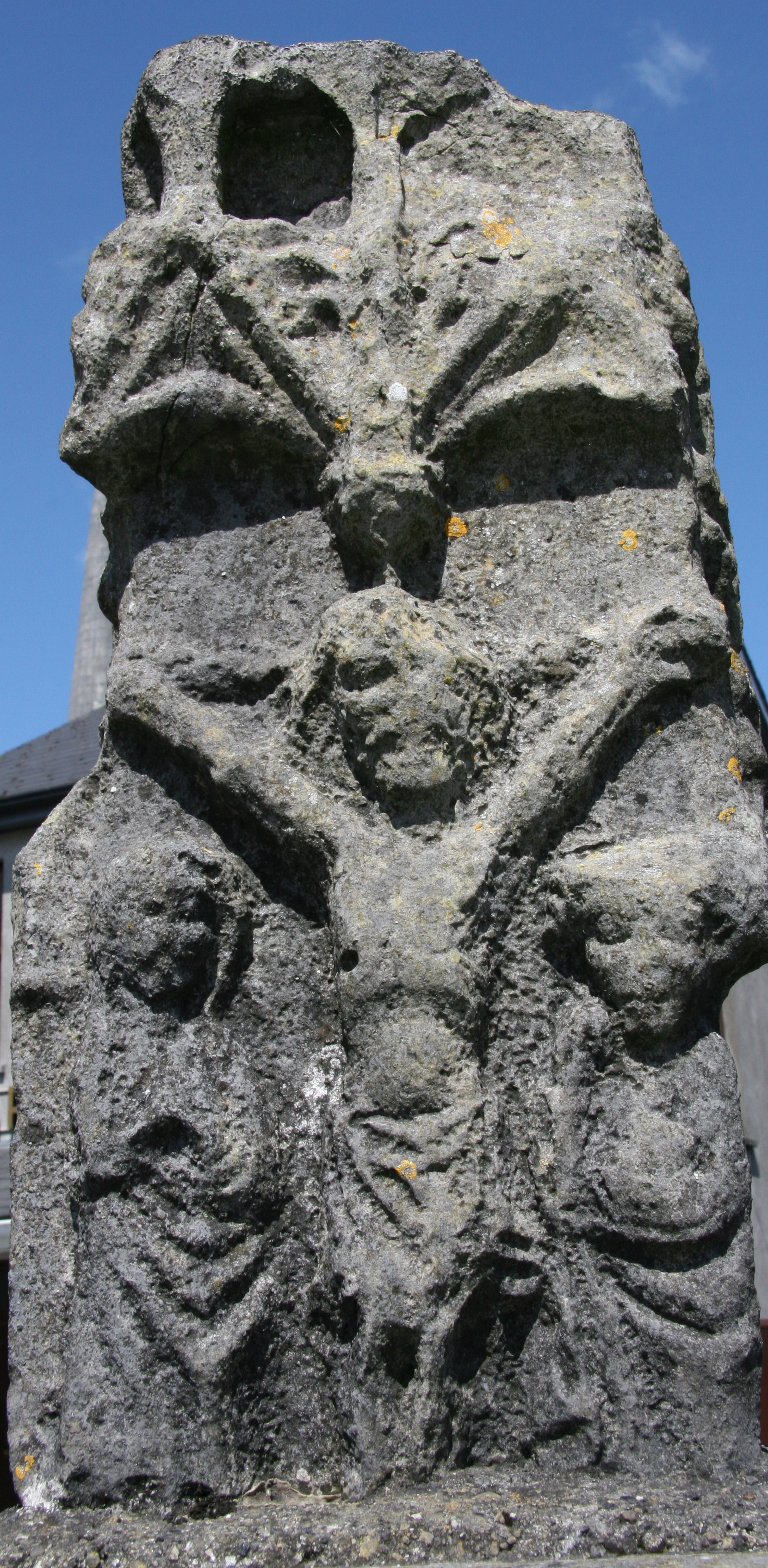
SLIDE 22. CLOSE-UP OF CROSS.
There is a carving of the Crucifixion on one side and Mary & Child on the other. There are animals at the base and was used to seal bargains made at market.
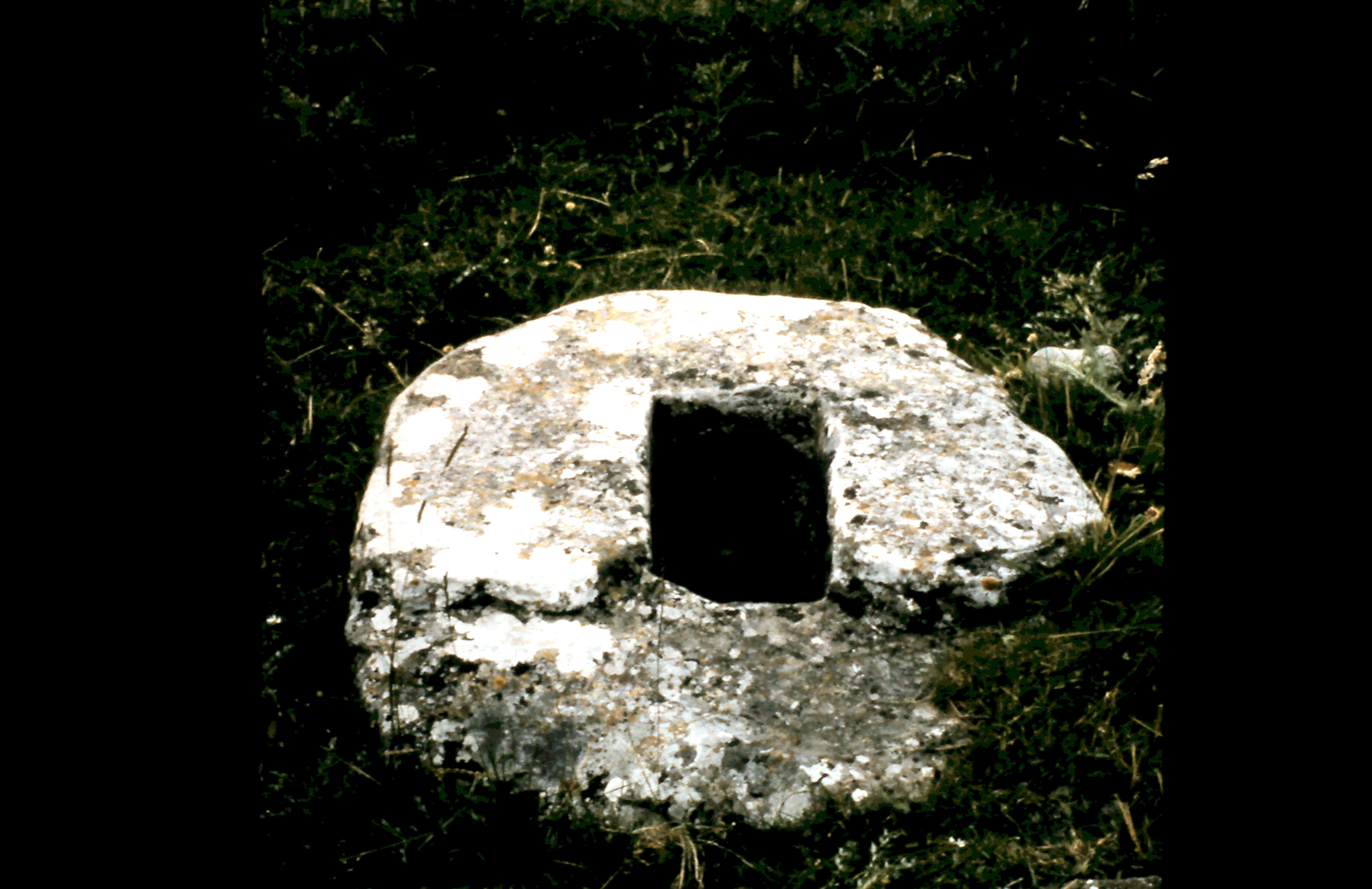
SLIDE 23. PARSON’S FAIR GREEN (Map)
The fairs were held each October 20th immediately outside the town walls, close to the gate leading to Galway (Lorro Gate). The site of this fair is marked on old maps as ‘Parson’s Fair Green’, and is marked to this present day by a large stone which has a rectangular socket cut into it, obviously to take a cross at which bargains could be sealed.
CONSOLIDATION
1. Questions on the above.
2. Further reading on Leprosy, Chicken-pox etc.
3. Write a newspaper account of a Fair Day in Athenry.
OTHER TREASURES OF ATHENRY.
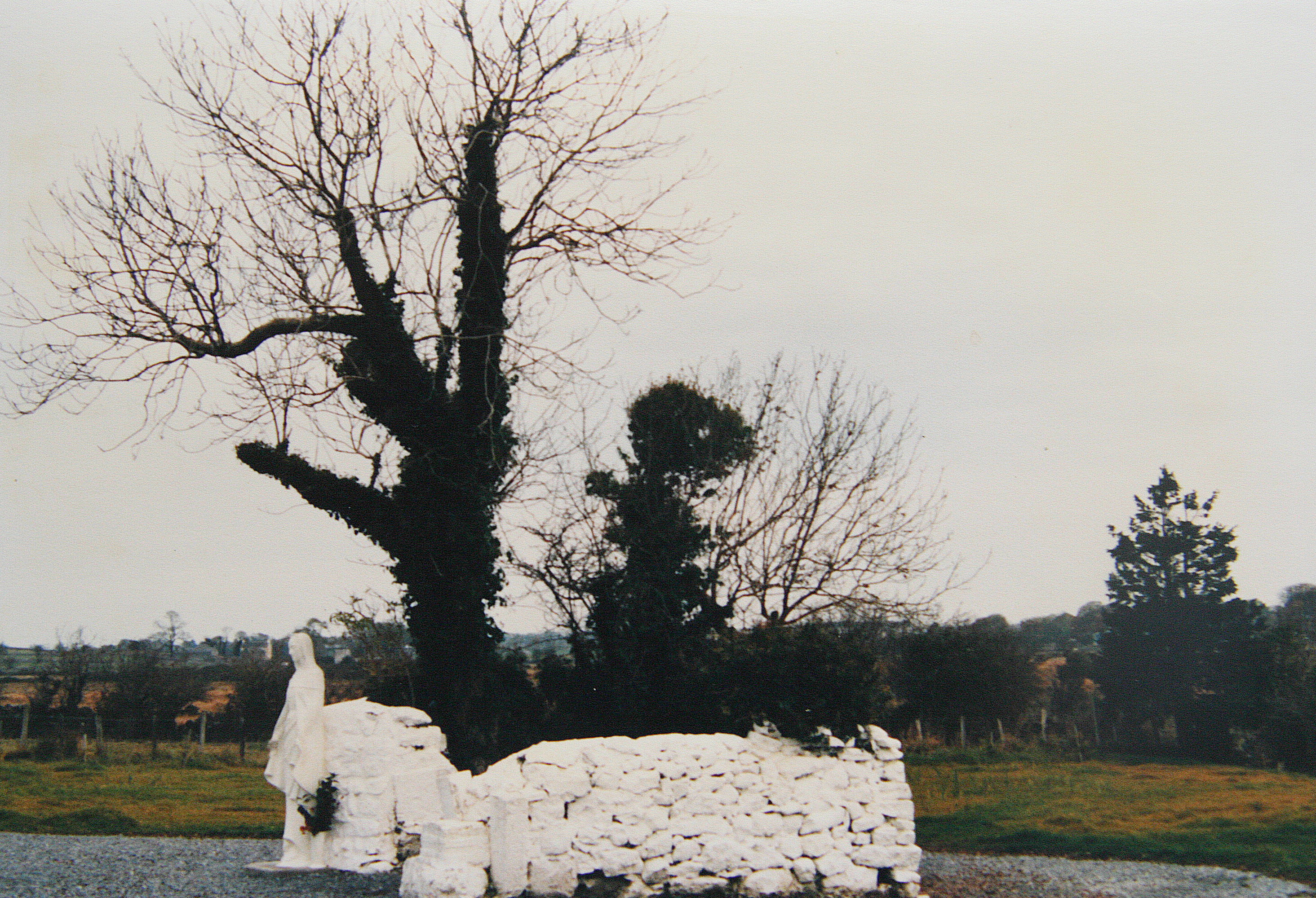
SLIDE 24. LADY’S WELL.
Probably Athenry’s oldest treasure and dates back to pre-Christian times. Water had a strong significance for ancient Pagan Celts, and with the coming of Christianity the well took on a renewed religious meaning for the early Irish Christians.
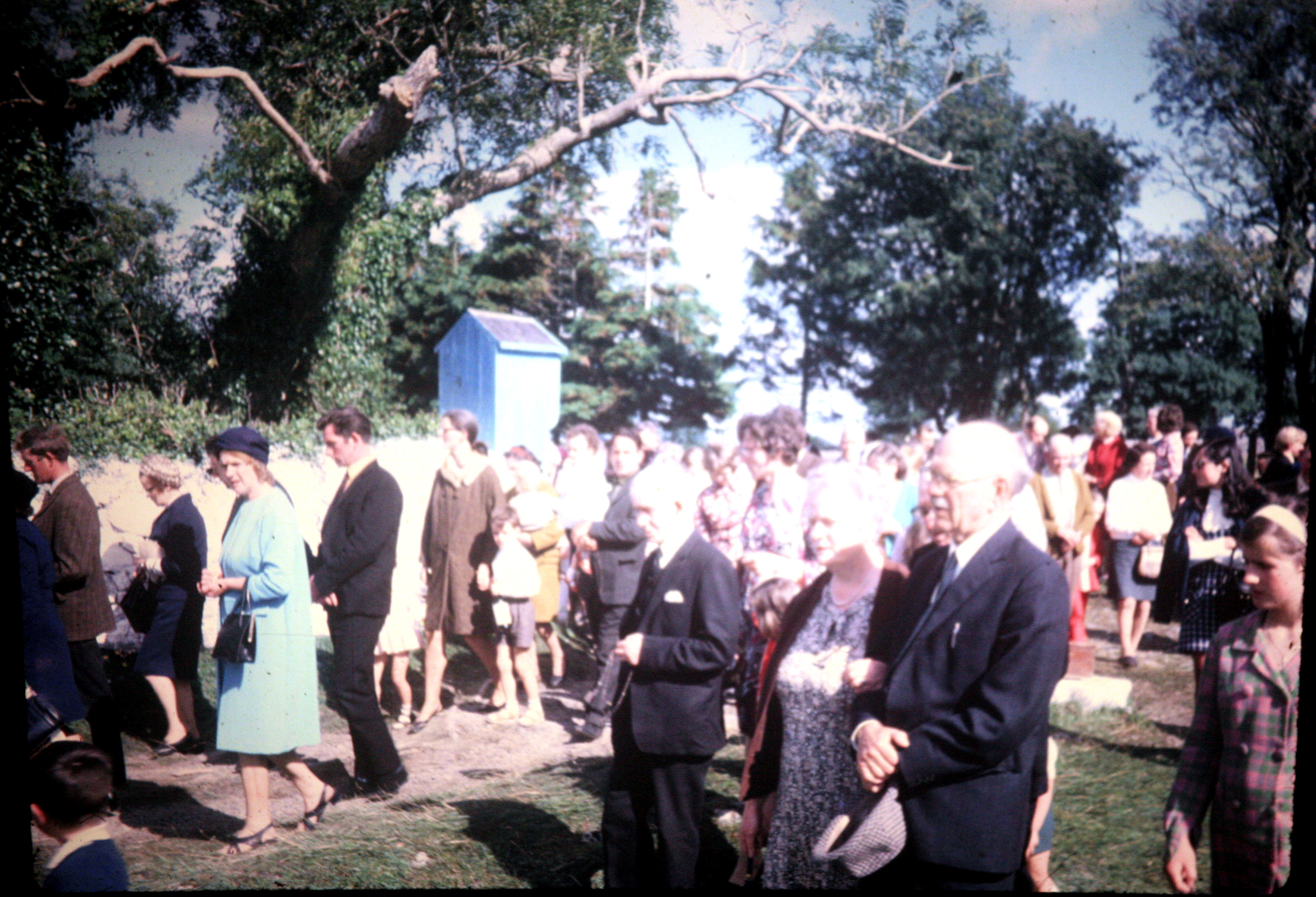
SLIDE 25. LADY’S WELL-DOING THE ROUNDS
Every day and especially on August 15th the well becomes a centre of religious ceremonies. People throng into it from many miles around, where Mass is celebrated and the stations of the cross are said.
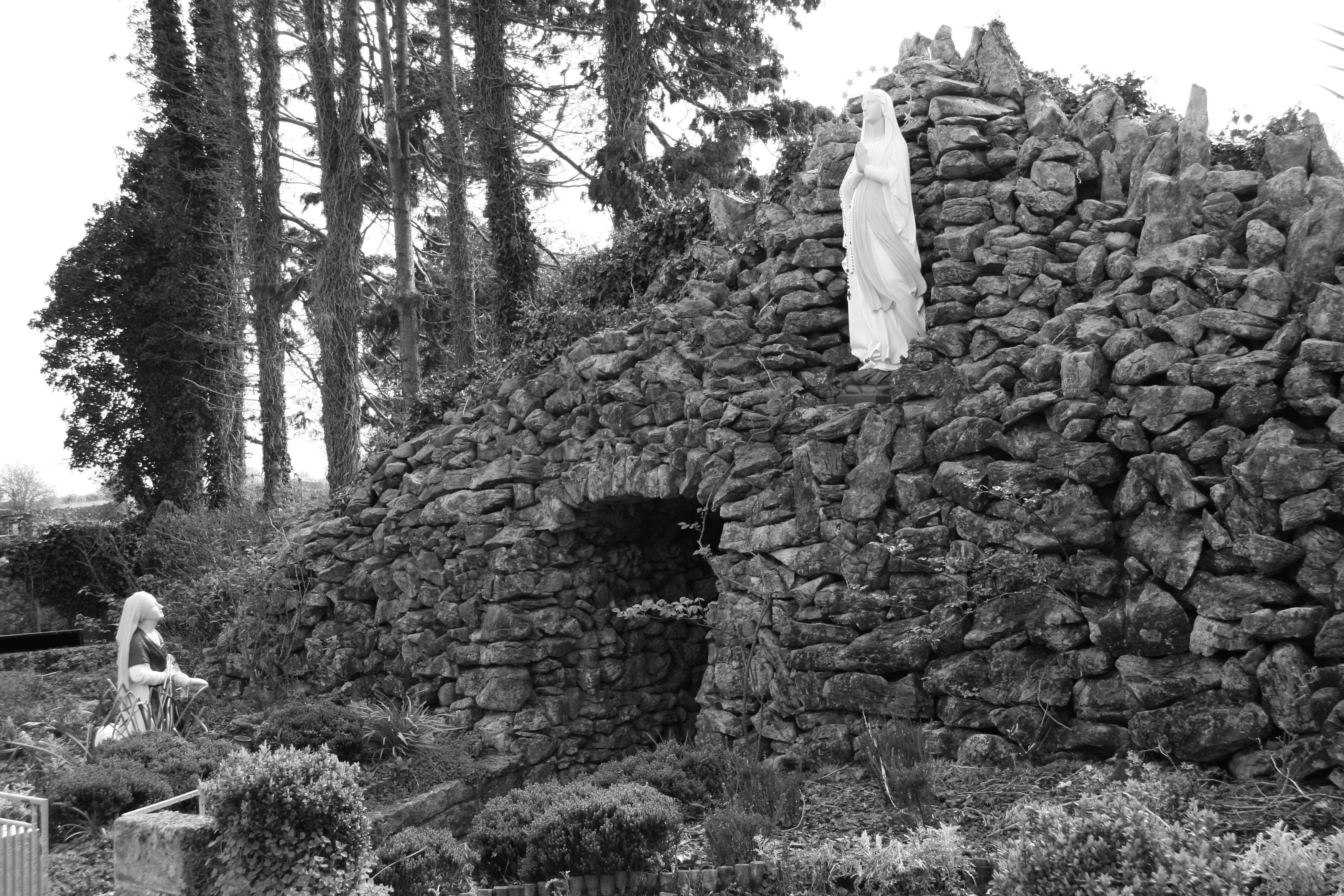
SLIDE 26. LADY’S WELL-GROTTO
View of Our Lady’s Grotto..
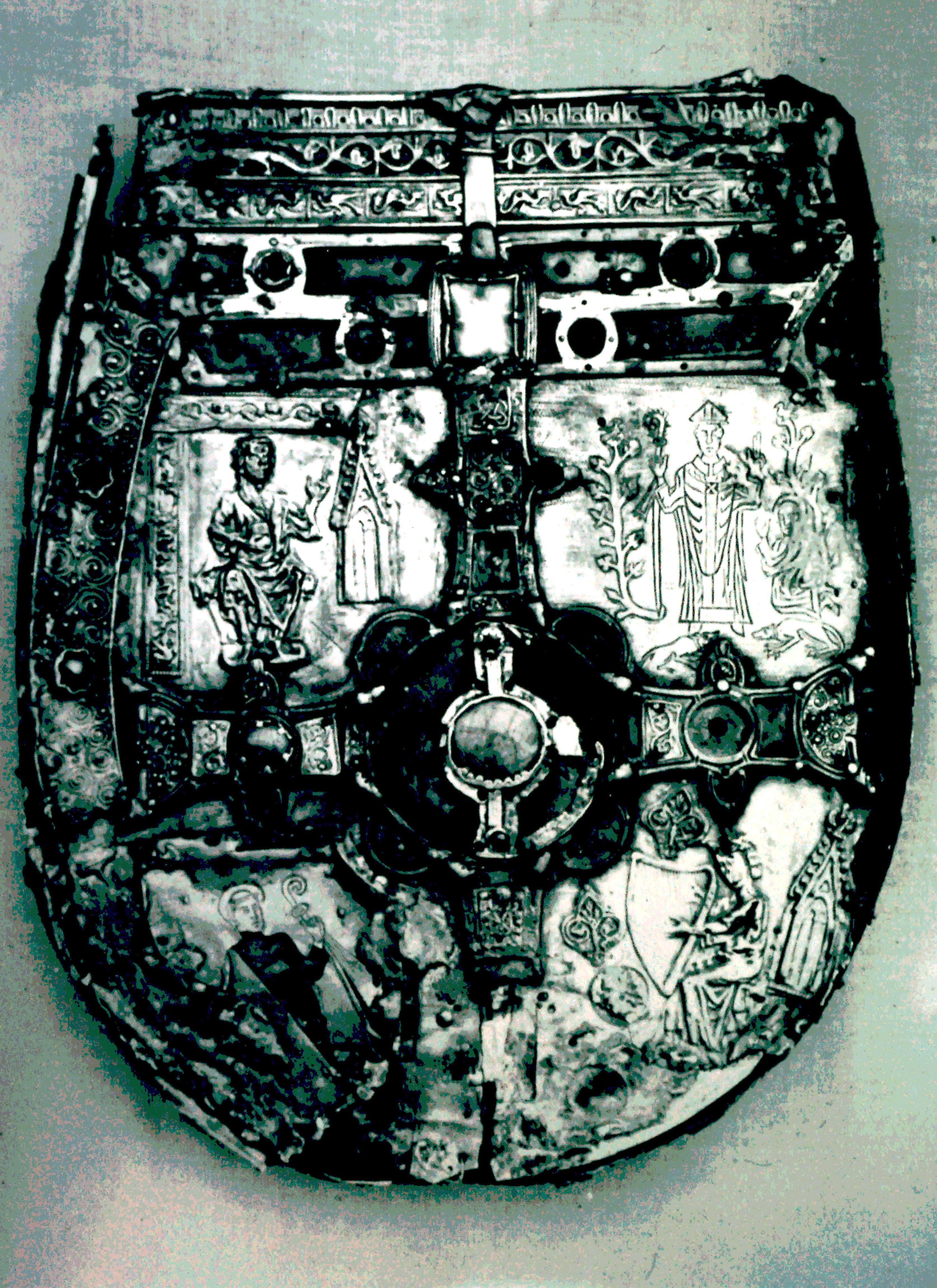
SLIDE 27. FIACAIL PHADRAIG – SHRINE OF ST.PATRICK’S TOOTH.
It was made to contain the tooth of St. Patrick, believed to be that which is said to have fallen on the door-sill of the church of St. Brone, at Killaspugbrone, Carbury, Co. Sligo. Across the centre of the front-face is the following inscription:- THOMAS DE: BRAMIGHEM: DNS: ATHUNRY : ME FECIT: ORNARI: P (R)) ISCA: PARTE: (translation :- Thomas de Bramighem, Lord of Athunry, caused me to be ornamented in the original portion) Thomas de Bramigham, Baron of Athenry, died in the year 1376 and was only Baron of Athenry who bore this name. The Shrine is of silver, richly decorated with figures in in bas-relief and settings of crystal, coloured glass and amber. On the front face is a figure of the crucifixion in full relief, accompanied by eight saints in bas-relief. The names of the four saints in the upper compartment are illegible, in the lower they are; BENON: BRIGIDA: PATRIC: COLUMCILLE: BRANDAN. The design on the back of the Shrine is cruciform, with remains of a setting of gold in the centre and panels of silver filigree. In the lower left compartment, King David is represented playing on the harp. The Shrine is mentioned as the most venerated relic of the province in a 17th century account of Connacht. It was for some time in the possession of the Abbot of Cong, and afterwards preserved by the Blake family at Blake Hall near Cong. Still in their care, the Blakes removed it to Menlough and later bequeathed it to Dr. William Stokes of Dublin, who deposited it in the RoyalIrishAcademy. From there it was given to the care of the National Museum where it is on view.
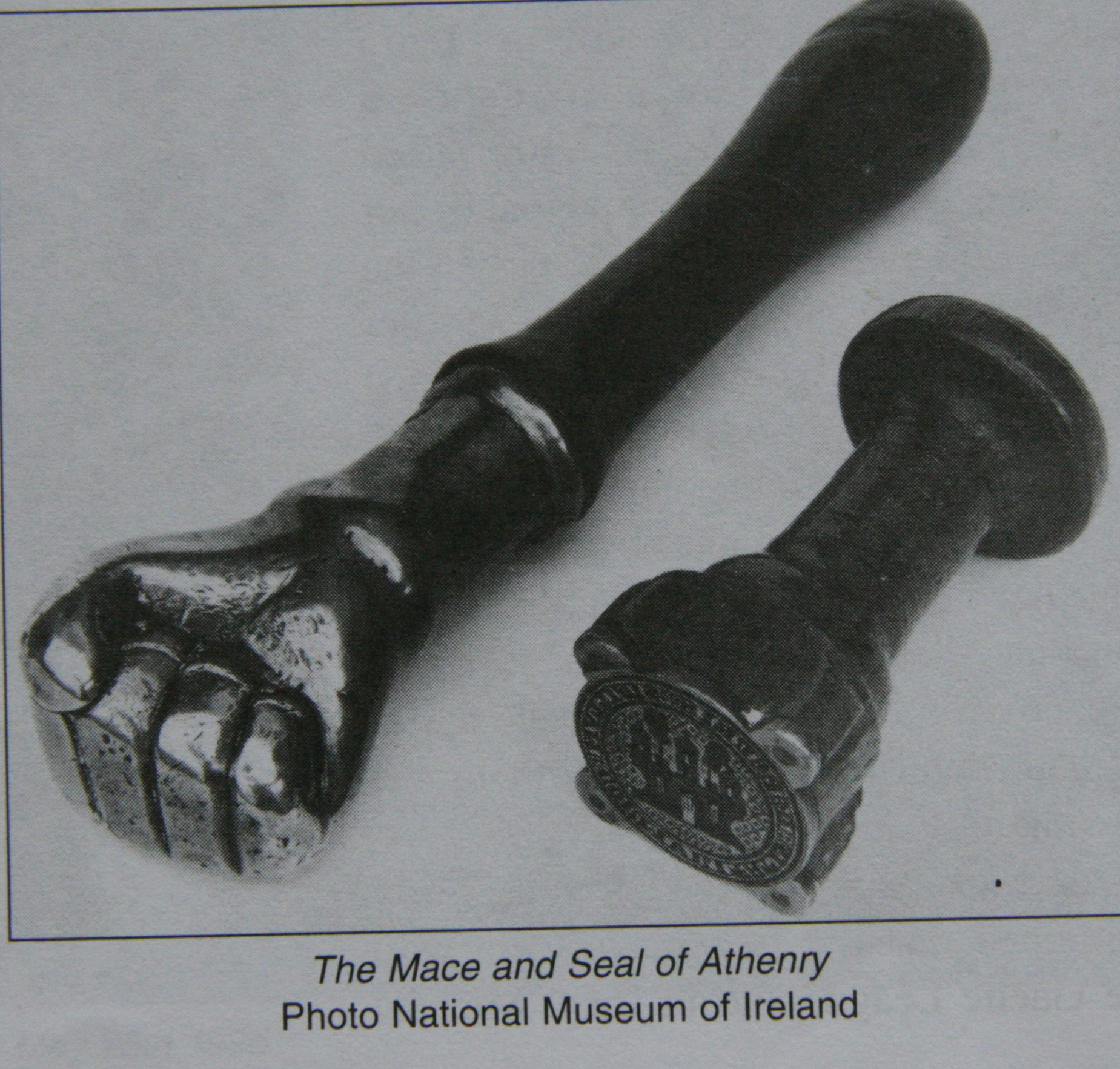
SLIDE 28: MACE AND SEAL OF ATHENRY.
Made sometime during the 14th century, these two treasures are of peculiar design and construction. The Mace is of singular design, being a clenched fist, cupped below the wrist, cast in solid laten or antique brass, measuring 4¼ inches in length and 3½ inches across the knuckles. It was mounted on an ashen handle, about 7 inches across. The weight of the whole was 1b.14¼ ounces. It was in fact a most effective weapon. One can suppose it was used to call meetings to order. The seal which was also of laten, was riveted to an ash handle. Its unusual design is of two heads fixed on spikes mounted on the castle battlements. These heads are very well designed and characteristically cut, bearing all the marks of Irish mode of wearing the hair and beard during that period. Historians speculate that they may be the heads of two Irish Kings, Phelim O’Connor, King of Connacht and Teige O’Kelly, King of Hymany, who were killed by the Normans in the Battle of Athenry in 1316. The legend round the Verge was SIGILLIM: AONMUNITATIS: DEHENRI: In 1874 the Maceand Seal were in the keeping of John Blakeney of Abbert, Co. Galway, whose family were formerly patrons of the Borough.
CONSOLIDATION
1. Questions on the above.
2. Draw and sketch the Shrine of St. Patrick’s Tooth, or Mace and Seal.
3. Write an account of ceremonies at lady’s Well August 15th.
SOURCES
‘Remarkable History of Old Athenry’- Connaght Tribune – February 1971 by Prof. E Rynne. ‘Shell Guide to Ireland’ (1967 a.d.) by Lord Killalin and M.V. Duignan. ‘History of Athenry (1980) by Sister Eugene. ‘The A.A. Road Book of Ireland’ (1970 ed). ‘Athenry’ – A Mediaeval Town – by Prof, E. Rhynne. ‘Athenry’ Co Galway – Bord Failte (1969). ‘Remarks on the Walls & Church of Athenry’ by Charles O’Neill J.G.A.H.S. Vol XI No 3,4. P132-141. ‘Notes on the Burgus of Athenry’ – J.G.A.H.S. Vol XI ‘Irish Castles’ by Harold G. Leask, R.S.A.I. 1941 No 1. P1-26 Leacht na bh Faltach I Mainistir Bhaile. Atha an Riogh le Mairead Ni Einhthigh M.A. Galvia Iml. 1955. ‘Guide to the Celtic Antiquities of the Christian Period’ by George Coffey – R.I.A. 1909 ‘Seal of Athenry’ J.R.S.A.I. Vol 3rd&4th Series (1874-5) ‘Mace of Athenry’ J.R.S.A.I. Vol. 29 (1899). ‘Dominican Priory of Athenry’ – J.R.S.A.I. 1895 also Vol. 43 1913 A special word of thanks to Miss Alice Downing M.A. – Ass.Librarian U.G.G. for her kind assistance.