APH
APH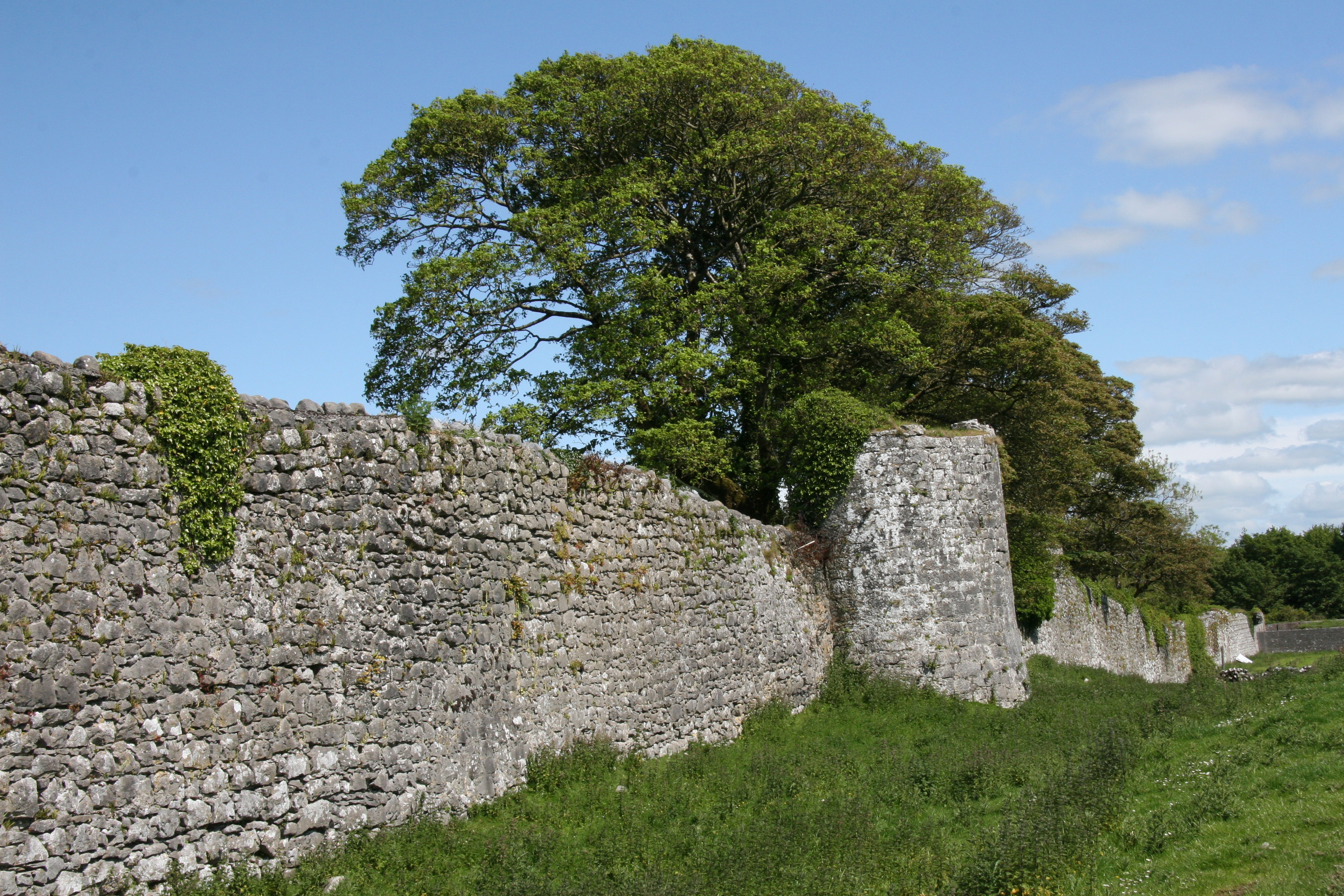
By Professor Etienne Rynne.
Assisted by Sean Cleary

During the spring of 1980 with the aid of a small grant from the Archaeological Research Fund of the RoyalIrishAcademy, I was enabled to undertake a measured survey of the town walls and towers of Athenry. A photographic record of them was also made. The work, which it is hoped to publish shortly, was done with the assistance of Sean Cleary, of Abbey Row, an architectural draughtsman and surveyor recently qualified with a Diploma in Building Construction Management from the Regional Technical College, Galway.
The Walls
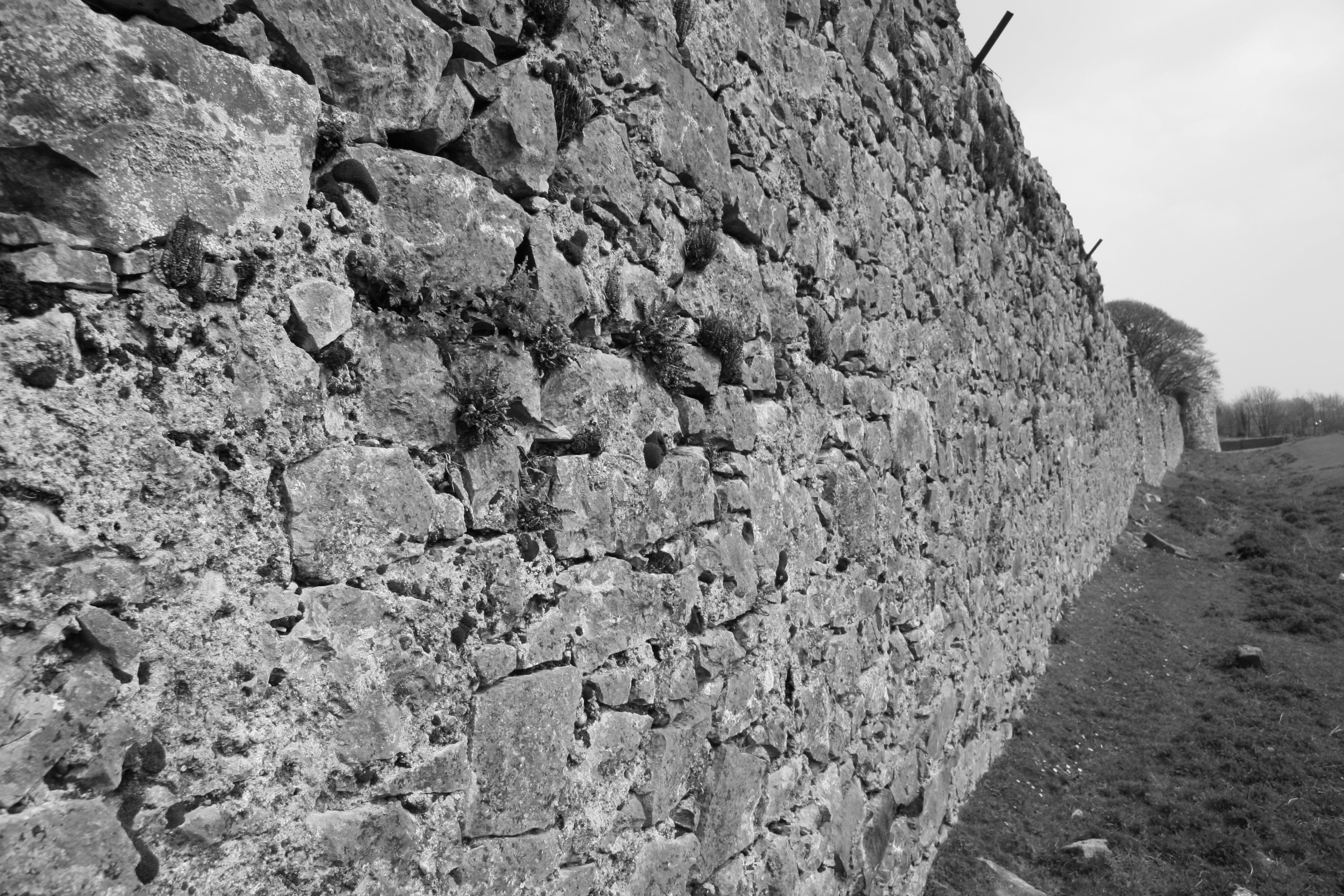 It was discovered during the survey that while the line of the town wall is almost complete, much of its structure is not in as good condition as appears at first sight: for considerable lengths the inner facing has disappeared, while elsewhere quite long stretches have been entirely, or virtually so, replaced in relatively recent times.
Built of mortared stone probably as long ago as the decade between 1310 and 1320, they average about just over 3½ ft. in thickness. They are generally appreciably higher from the outside than from the inside, where the ground is, for the most part, higher, due to accumulation of stones collapsed from the walls and/or to the presence of gardens. Allowing for the varying height of the walls at present, they seem to have originally been about 4.5m (14¾ft.) high on average. However, this measurement includes a 1m (3¼ft.) high and 50cm (1ft.8ins.) thick outer parapet, evidence for which was discovered in one or two places. Indeed, this discovery was one of the more exciting made during the survey, indicating that the walls were not merely built as an intimidating protective boundary around the town, but were militarily functional insofar as defenders were able to parade the top of the walls, defending it from vantage points other than the wall-towers and gates.
The defences were further strengthened by a wide, apparently flat-bottomed, fosse (moat) with a low outer bank. This fosse was almost certainly filled originally by water diverted from the River Clarin; it averages about 8m (26ft.) in width, its outer bank being about 1m (3¼ft.)high.
The Wall Towers
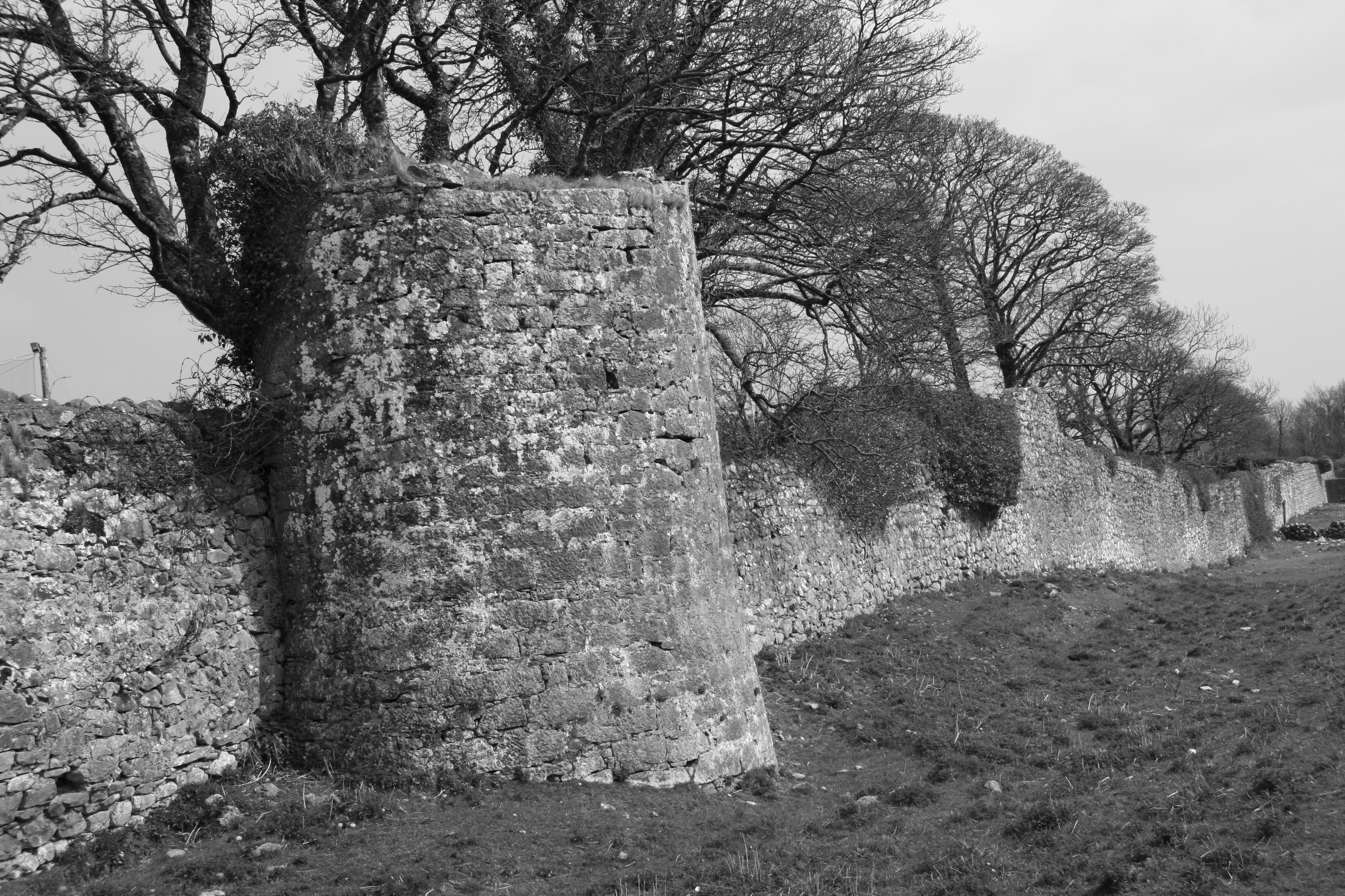 There were originally at least six fairly strategically- placed towers on the wall. None appear to have been properly bonded into the walls, though they are not necessarily later additions and can be paralleled with wall-towers on other 13th-14th century town –walls in Britain and Ireland. Five of the Athenry wall-towers remain to an appreciable height, but the sixth behind Brady’s of Church Street, is no longer- its lower courses were inadvertently bull dozed away (and the adjacent portion of the fosse filled in) towards the end of May 1980, unfortunately just before it was to be surveyed, though fortunately two colour slides of it taken some six or seven years ago exist. The best preserved of the towers is that on the north-western corner of the walls, now in the grounds of the Presentation Convent. It rises 10.10m (almost 33ft) in height above the ground outside. Like the other towers, it was built with a solid base, with an external batter it measure about 5m (16¼ft) in diameter at its base and 4.50m (14½ft) in diameter at its top. There were two entrances to it, one from the top of each adjoining wall, so that defenders would pass through the tower as they paraded the town-walls. Within the tower was a short stairway leading to a partitioned room which had internally-splayed slit-like windows allowing those within to oversee the outer faces of both adjoining walls and also to survey the area straight out from the corner itself. The other remaining towers all had some or other of the features noted in the north-western one, and were therefore probably all basically similar originally.
Town Gates
Even though a plan of the town dated 1583 only shows four entrances through the town-walls (one through the west wall, two through the south wall, and one through the east wall), it would seem rather unlikely that there would not also have been one through the north wall too.
North Gate
 However, whether there was or was not a northern entrance in 1583, the only remaining gateway is the North Gate (or “The Arch”) at the very place one would expect to find one. Although much of the present structure is restoration work (e.g. the bordering-stones of the arch itself are clearly of 19th century date,) there is nothing particularly post-1583 about it and it may well date from much earlier.(but see below).
The North Gate was entered from the wall top, probably at or near the entrance made in its western side during the excellent restoration carried out by the County Council; although there is now no sign of any entrance in the eastern side of the structure, it would seem that there ought to have been one there too, thus allowing defenders to move to and from the gate-tower to both adjoining walls. Access to the top of the gate-tower would undoubtedly have been up a ladder from the room above the arch and through a trap-door in the top –regrettably this was not realised when otherwise excellent reconstruction was being undertaken, with the result that there is at present no means (other than by using scaffolding or long ladders from the roadway or from the local fire-engine!) of reaching the roof.
The minimum width of the passage through the gateway is 3.10m (just over 10 ft.). A large, wide slit in the back of the floor of the room above the arch (i.e. through the ceiling of the arch) indicates that the gateway was closed, when required, by a very stout, wooden portcullis. Also through the ceiling of the arch, centrally placed outside the portcullis slit, is a ‘murder hole’, that is , a large rectangle hole through which stones, spears or other such offensive projectiles, could be hurled at attackers under the arch attempting to destroy or lift the portcullis. This ‘murder hole’ can be paralleled inside doorways of Late Medieval Tower Houses, and such might be looked upon as perhaps indicating a post-1583 date for the arch.
Brittin Gate
That leading to the east was called Brittin Gate and was across Bridge Street – this gate’s name comes from the owner of the land there in the middle of the 13th century, Sir Robert Braynach (<Breathnach <Briton =Walsh/Welsh).
Loro Gate and Spittle Gate
The two gates leading southwards were called Loro Gate and Spittle Gate. The former was across Old Church Street and is often popularly referred to as ‘Swan Gate’ a name apparently derived from a public house or inn, which is thought to have been formerly near the spot. Loro Gate led on to Bohareen Ard, the old road by Higgins’ garage (until recently traces of it could be seen as it curved towards the present Galway road).The other gate through the southern wall, the Spittle Gate, was at the present entrance to Taylors near The Pound, and it clearly got its name from a hospital, which was associated with the Leper Compound which, in Medieval times, was sited roughly where the Kenny Memorial Park now is. The road, which entered through it was the Old Munster Road, that which led towards Ennis and Limerick; having passed through the Spittle Gate it joined up with Cross Street, roughly following the line of the present avenue through Taylor’s. The survey revealed that the stretch immediately to the west of the Spittle Gate was the façade of a building with nine narrow internally-splayed windows low down and three large ones above; although the lower windows resemble those in the wall-towers, the upper ones suggest a later, possibly 16th or even 17th century, date for this building. The adjacent present gates, however, are late 18th or early 19th century.
The Castle, Dominican Priory and St.Mary’s Parish/Collegiate Church were also surveyed, though not in same detail as the walls.